Breheimen 2017

When
6-14 August 2017, 8.5 days of walking
Where
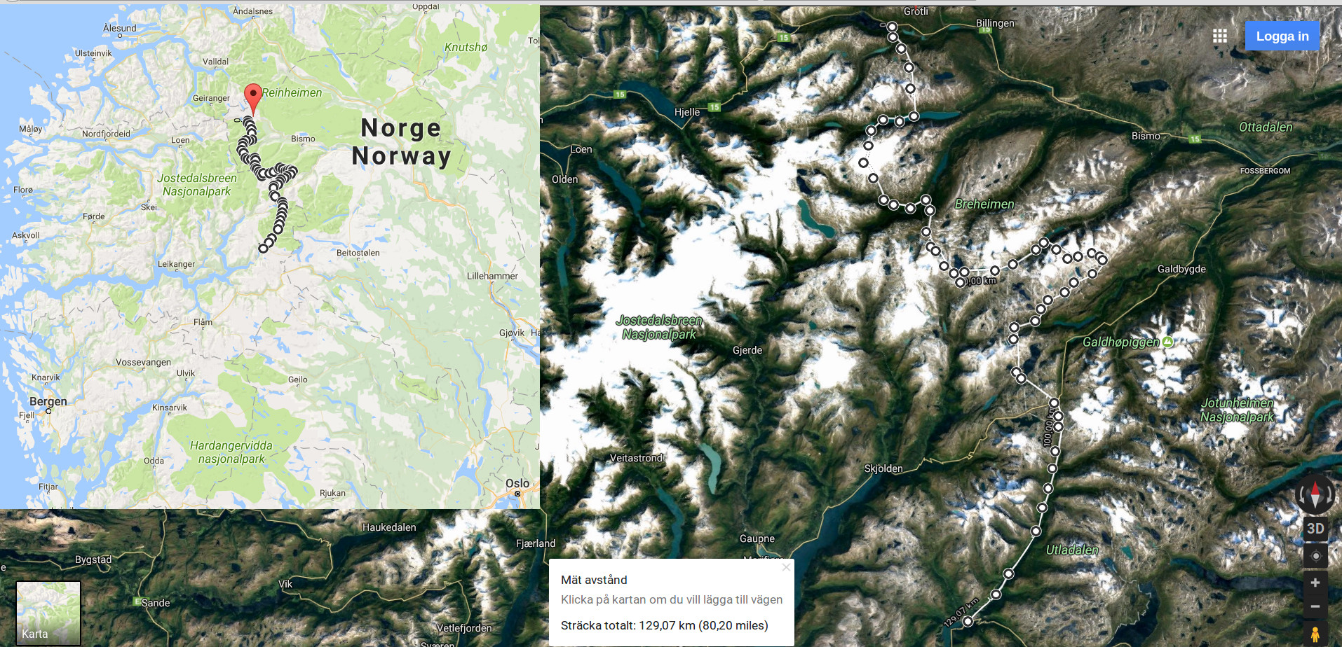
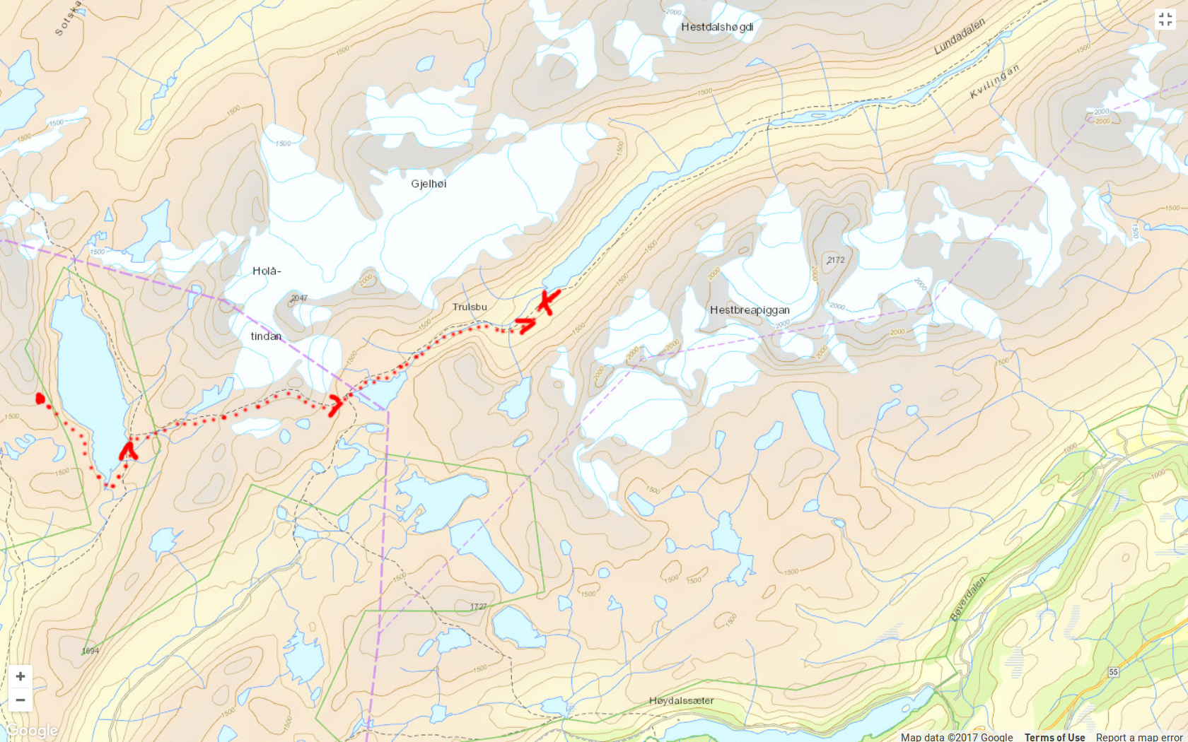
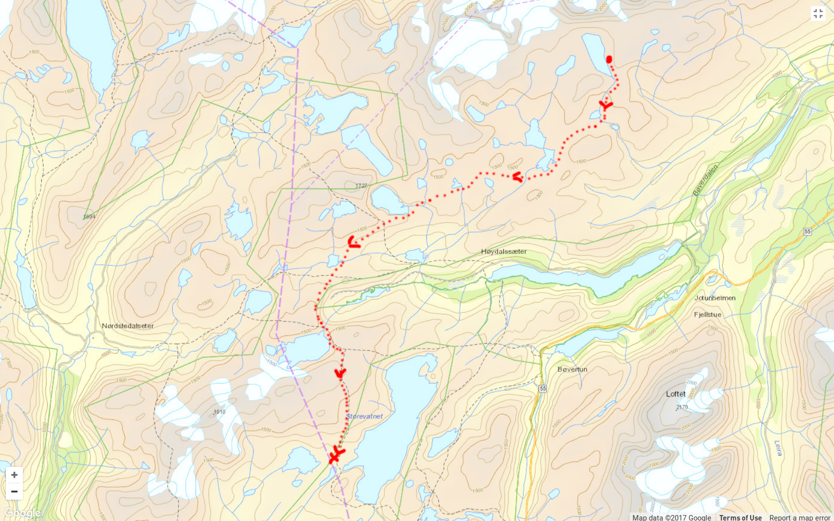
Breheimen / Jotunheimen national parks, Norway. Very roughly, the route was as follows:
6-14 August 2017, 8.5 days of walking
Breheimen / Jotunheimen national parks, Norway. Very roughly, the route was as follows:
Daytime 0...15°, mean 5...10°. Nightime -2(?)...+5°. Rain every day, graupel and snow at higher elevations, constantly high humidity, heavy winds.
6 kg base weight + 6 kg of food. A flat silnylon tarp for shelter, quilt, trail running shoes, ice axe, crampons. For more details, see spreadsheet.html
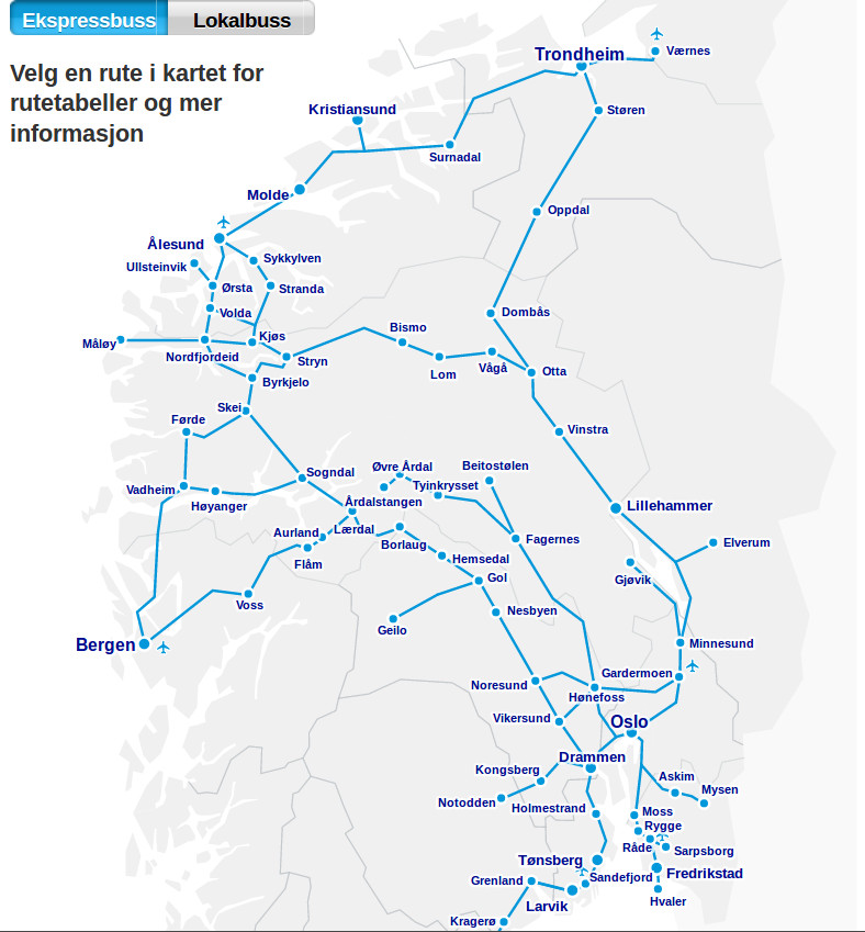
From Oslo, you can take a bus to either the northern or the sourthern end of Breheimen / Jotunheimen, say to Bismo / Strun / Övre Årdal / Sogndal. I started in Grotli and finished in Övre Årdal. Here is a map of bus routes from nettbuss. Another option is to use nor-way
I used a single paper map, namely Breheimen Topo 3000 1:50 000. An excellent online resource with free topographic maps is www.visitnorway.no

Grotli itself is just a hotel in the middle of nowhere, off the road to Geiranger, and its only distinction is to lie in the middle of nowhere:

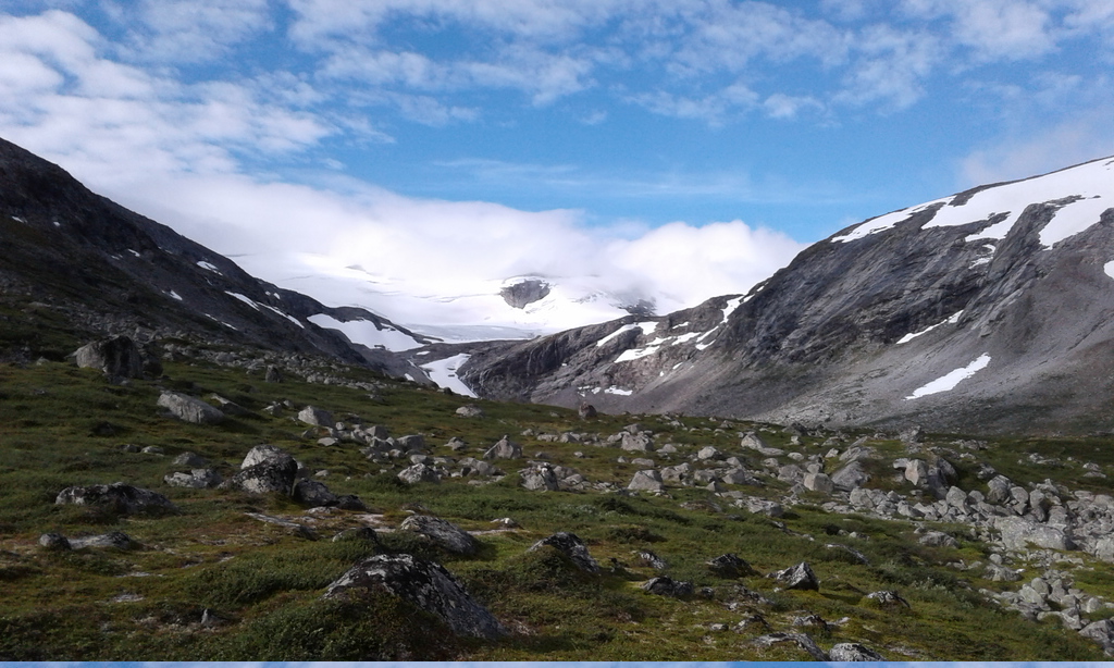
But Grotli a convenient entry point, since it already lies fairly high at ~1000 m of elevation, and there is a marked path leading from Grotli south into Breheimen. The path is apparently not used very much, but there are enough cairns to follow it over the 1500 meter-high pass to lake Rauddalsvatnet:
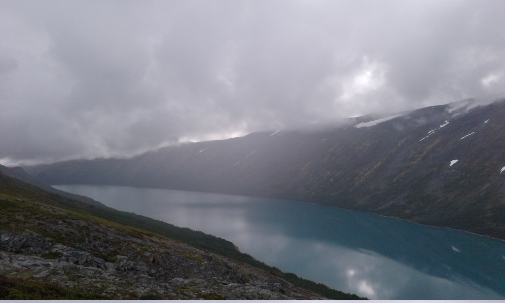
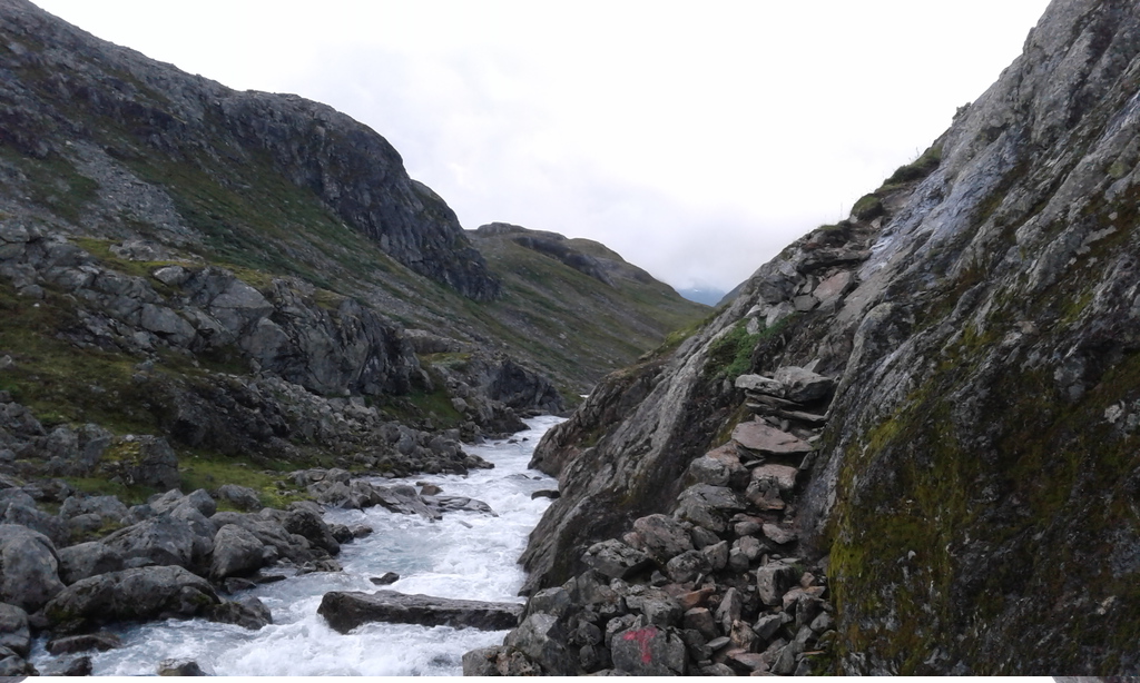
The descent is steep, and the dense vegetation makes traveling along the shores of the lake painfully slow, despite the path that winds its way through the brush. It took me the better part of the day to finally reach the western end of Rauddalsvatnet, and to be honest, I was quite happy to see the last of this scenic lake:

Immediately west of Rauddalsvatnet the landscape finally becomes more alpine and the going gets dramatically easier:
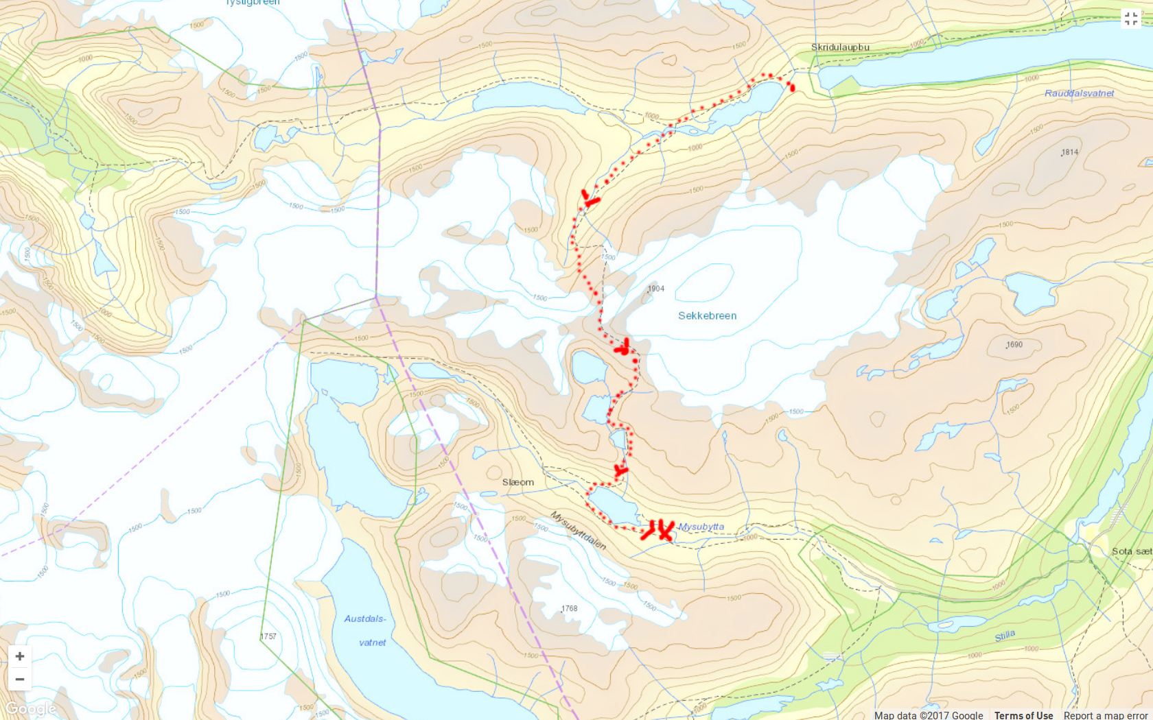
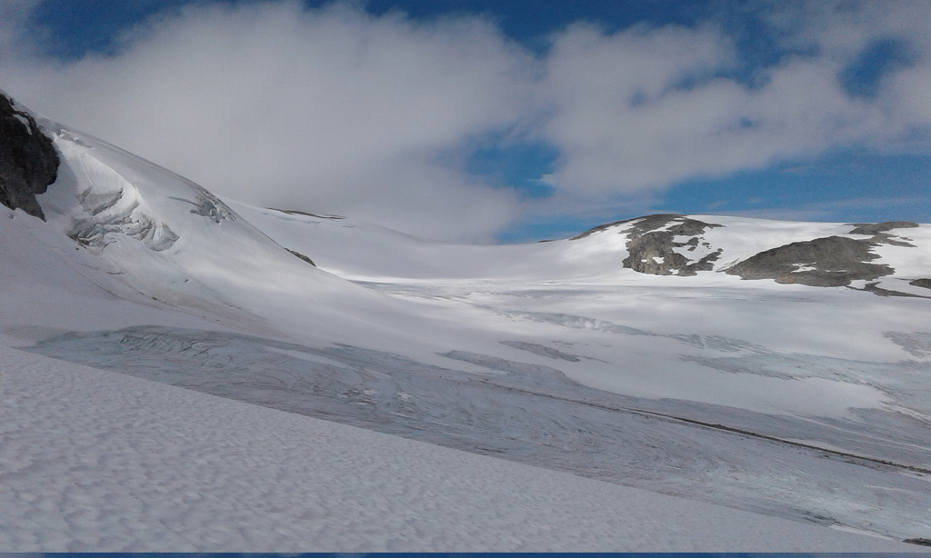
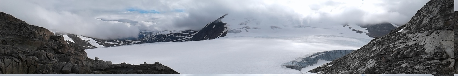
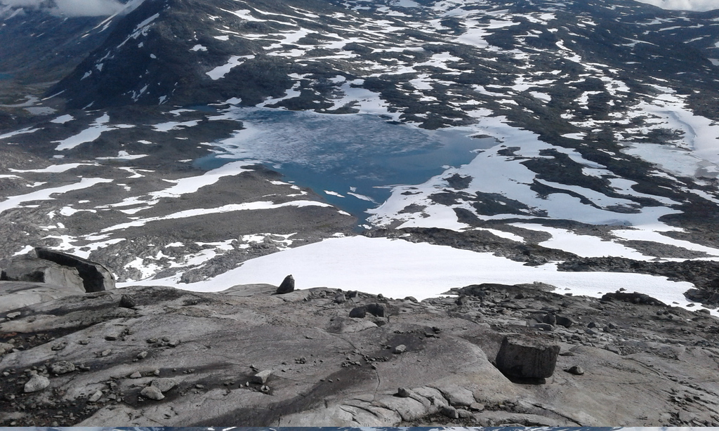
To continue south, one can pass in between two glaciers: Sikilbreen and Sekkebreen. This is a beautiful and fairly simple trek. Even in August the pass was covered with extensive snow fields, and the glaciers themselves were mostly snow-covered as well, hiding the cracks and making ice travel hazardous. There is an ice-free route, though, and you don't really have to use crampons, although they may help:
The climb to the pass is followed by a long but gentle descent over rocky slopes, past several beautiful lakes and finally into the deep valley of Mysubytta. The elevation gain and loss is about 800 m.


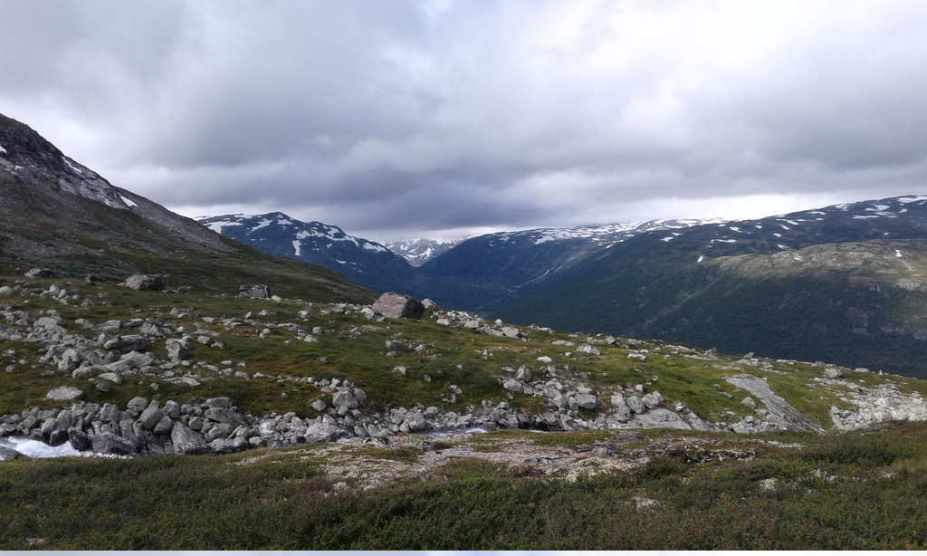
Compared to the strech from Grotli, Mysubytta valley is like a highway, and it shouldn't take long to descend towards the hamlet of Mysubytta. The broad valley leading east to Sota seems to be an unlikely place for a good hike, but it's more pleasant and isolated than the map suggests. There is a path (unmarked on my paper map) that follows the river and allows you to avoid the unpaved road altogether. The pinewoods and views of the mountains further south make this a very relaxing and pleasant walk:

The village of Sota lies at about 700 m, but you don't have to stay in the subalpine zone for long - a short climb along either of the two paths leading south brings you right back into the open, windswept environment that Breheim offers in such abundance:
Here there is a decision to make. One trail leads straight to Illvatnet, while another veers off westward and crosses the glacier of Fortundalsbreen. I followed the latter route as far as the lower reaches of Fortundalsbreen, which were covered with snow-free blue ice and could be tackled safely, and then left the glacier to continue towards Illvatnet over the intervening hills. There is very little vegetation at this elevation (1400 - 1700 m), and the terrain looks rather inhospitable:


Then again, the landscape appears more welcoming as soon as the clouds lift a little:

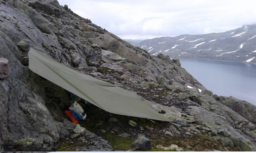
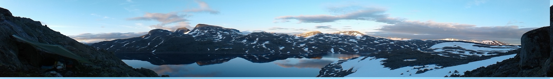
There is a lot of snow, ice, and rocks - and very little soil - aroud Illvatnet, so finding a place to camp can be a bit of a challenge. Fortunately, a tarp can be pitched even on a narrow ledge, giving its inhabitant an unorthodox camping site and (weather permitting) majestic views at sunset:

An easy-to-miss and poorly marked trail leads from Illvatnet east, past Holåbreen glacier and then either north into Lundadalen or south into Middalen. The climb to Holåbreen proceeds over rugged, but not particularly challenging terrain, culminating in the slow ascent to a 1800 m-high peak overlooking Holåtindan. Most of this route was completely snow-free, in contrast to the descent into the valley below, which was one giant snowslide, only broken here and there by outcrops of completely barren rock.


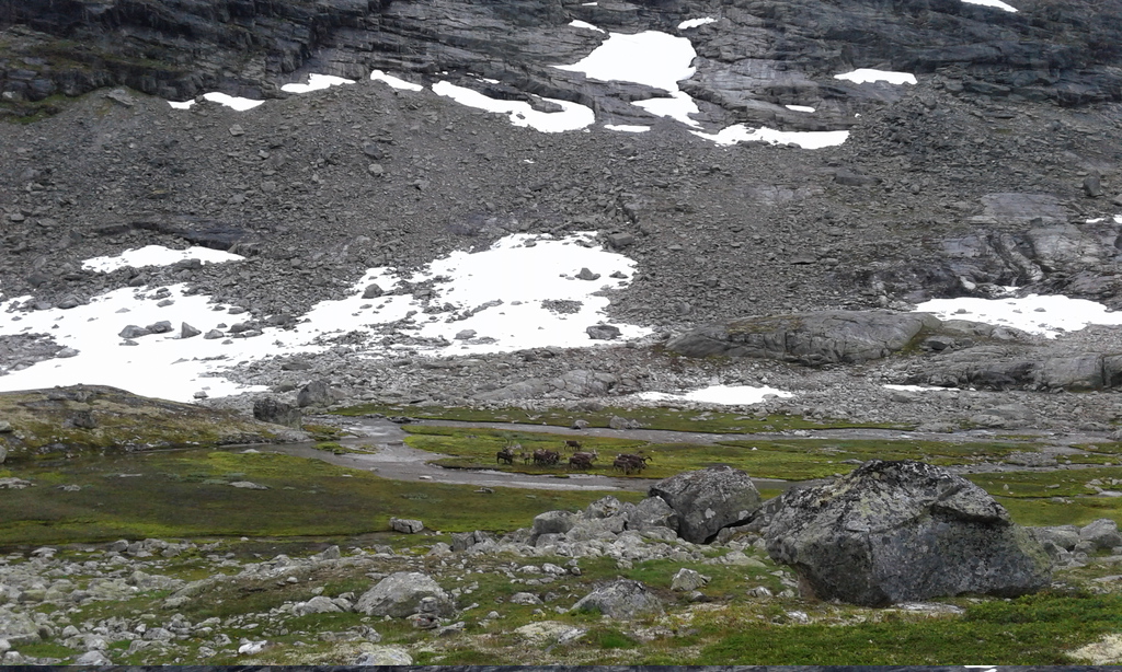
The welcoming valley of Lundadalen offers a pleasant contrast after this dramatic, high-altitude landscape. Apparently, the reindeer agree:

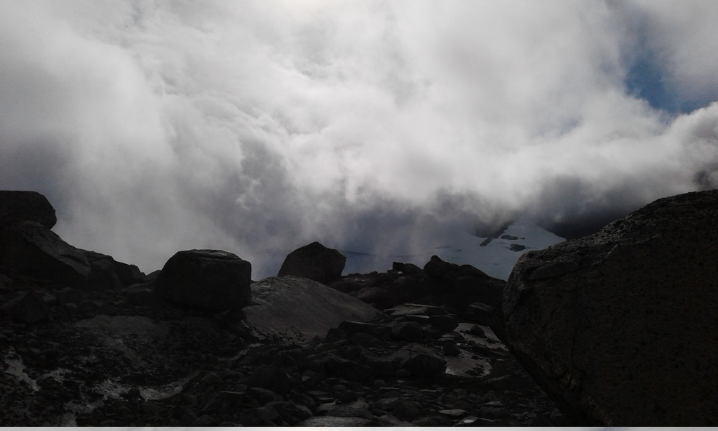
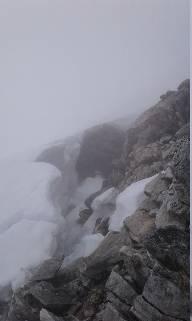
My original plan was to cross the ridge barring the way south from Lundadalsvatnet by scrambling up the slopes over Lundadalsvatnet and following the ridge east until a suitable spot could be found for descending. Unfortunately, the weather, which was tolerable over the first few days despite intermittent rain, deteriorated just as I was ascending. I was in the middle of a raincloud (later on, snowcloud) by the time I reached the first peak at 2100 m, with views roughly like this:
As a result, I cannot provide a good description of the ridge, beyond saying that ascending from Lundadalsvatnet is straightforward, albeit slow because of the steep angle, unstable scree, and the sheer number of vertical meters (from ~1200 m to over 2100 m). The ridge is easy to follow after that, even in a cloud. Given the strong winds and sleet followed by graupel followed by snow, I was not eager to linger at the top and descended at the first opportunity to do so without any visibility, relying purely on the gps. I followed the ridge all the way to Heksete, which is marked by a large tower made of rocks, and then clambered down Heksetesbrean (part snow, part glacier) using crampons and an ice axe. I don't think this route would be safe, and perhaps even impossible, without crampons, since the upper reaches are steep and there are patches of pure ice. Höybrean further west looks a bit less steep on the map and may offer a safer route down, but I cannot vouch for its condition, since I literally didn't see a thing through the fog.
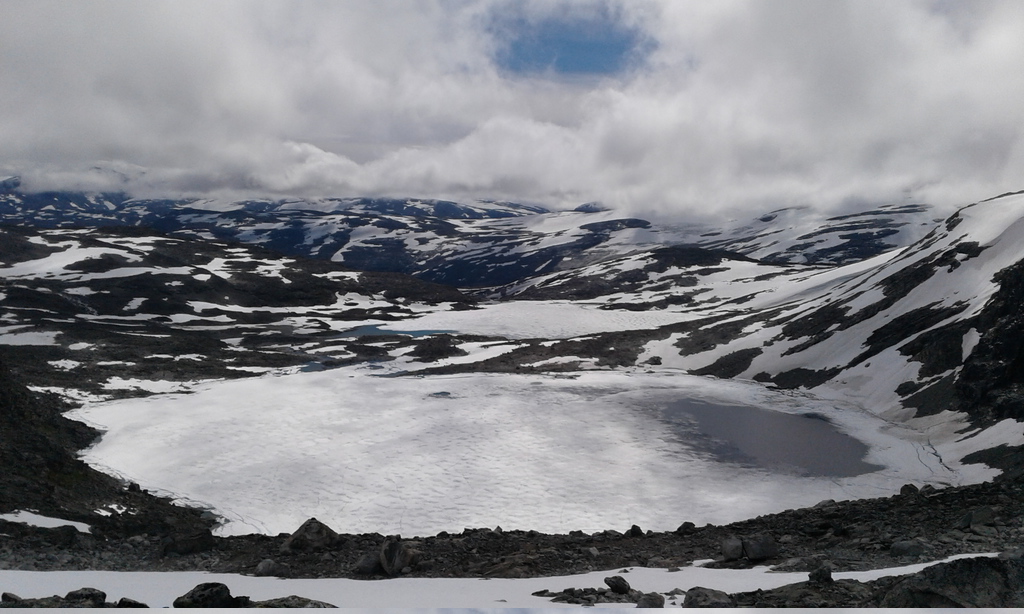
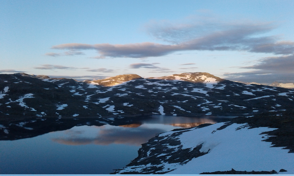
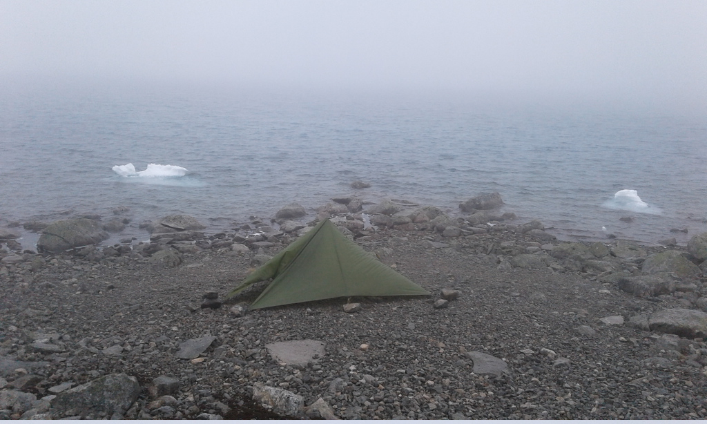
Once safely down south of the ridge, I found myself on the plateau of Steinahöfjellet at a more livable altitude of 1600 m and back in a raincloud - no more snow. Crossing the plateau is not difficult, although the continuing lack of visibility provoked some unnecessary detours. There is no vegetation and little soil, so camping spots are few and far between. This was my highest and windiest camp, at 1550 m on the shores of lake Höybreavatnet:
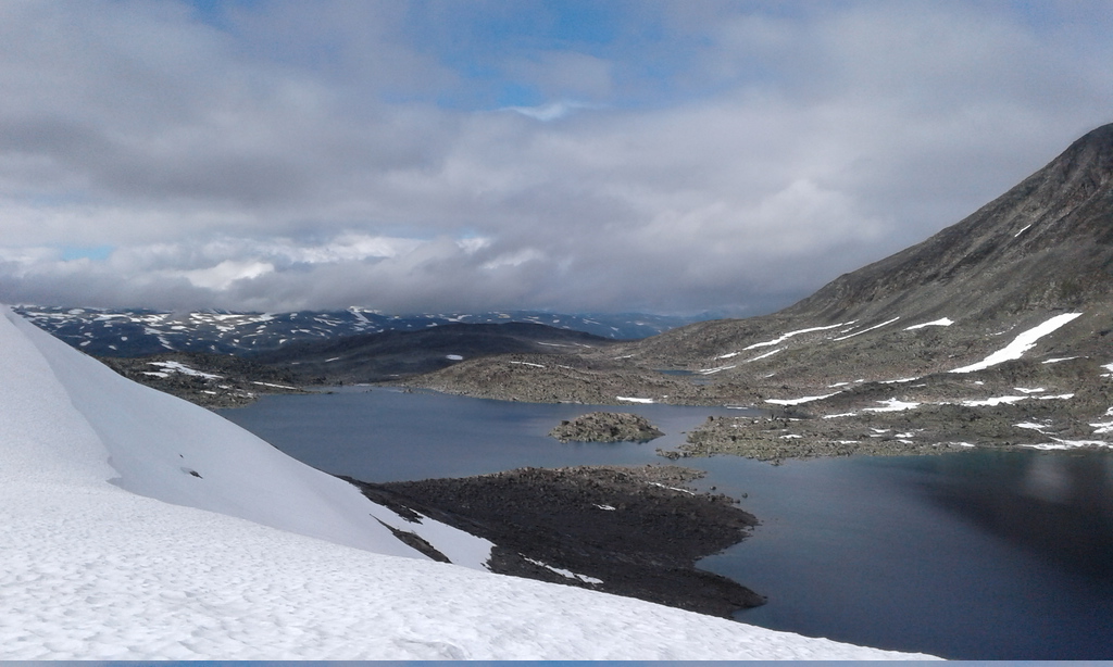
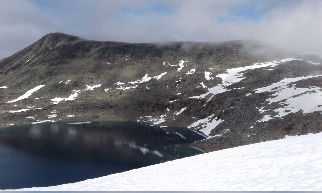
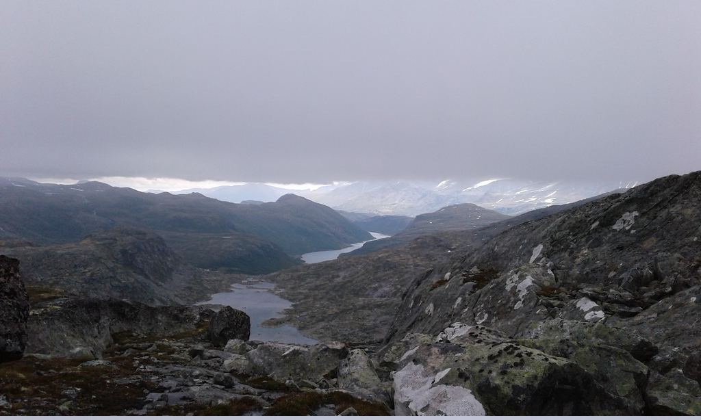
Getting to Storevatnet is a simple matter of continuing to cross the plateau, slowly losing altitude and minimizing unnecessary climbs. There are no trails here, but the terrain is easily navigated (again, even in a cloud). I followed a chain of small lakes to Geittjonne, thus avoiding a descent into the deep Höydalen. This country is very desolate, wild, and probably picturesque in better weather, but the clouds seldom lifted high enough to give me a glimpse of the area I was traversing. When they did, though, the effect was sometimes dramatic:
There is a decently marked, but little-used trail leading south from Liabrevatnet and on along the shores of Storevatnet, where I made camp among very rough, broken terrain (no reasonable camping sites anywhere along that stretch). I was getting tired of the icy rain and wind by then. A long-sleeved shirt, a fleece hoodie, and a winter-warmth synthetic puffy under the rain jacket stayed on the entire day:
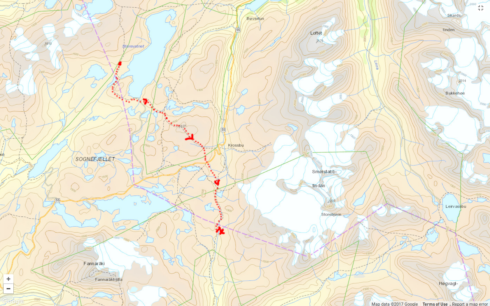
The way around the south-western corner of lake Storevatnet looks simple on the map, but in reality the ground is so uneven that it takes a long time to navigate this maze of gullies and boulders. There are cairns, but I had some trouble following them in the continuing low-visibility conditions. After crossing the dam at the southernmost tip of Storevatnet, the trail climbs higher and ultimately goes over the top of Krosshöe before plunging into the valley below towards Krossbu and Highway 55. The stretch over Krosshöe seems pleasant, but it was high enough to bring me smack into the middle of a particularly dense cloud, so the visibility was non-existent. Once over the top, I cut a corner by avoiding the descent towards Krossbu and instead headed southeast across the easily navigable meadows, rejoining the trail at the landmark glacier of Smörstabbstindan:

The entire stretch from the top of Krosshöe and south as far as Skogadalsböen (see Day 8) offered the easiest walking on this entire route. The contrast is particularly remarkable compared to the extremely rugged, slippery, and barely used trails around Storevatnet. Here there is finally a well-trodden path, and the valley bottom is fairly even and covered with grass. This region is also clearly more popular with tourists, and I met the first Homo sapiens since Sota (Day 3).

After a cold, still, moonlit night promising drier conditions I shook the ice droplets off the tarp and started my long descent from the pass of Rundhaugan (1500 m) into the mighty valley of Utla. The landscape is alpine until the joining of two valleys: Vetle- and Storutladalen. At some point the valley almost becomes a canyon, but the path is uniformly good, making for good speed. At this point lemmings suddenly became abundant and continued to scamper about the path ahead of me all the way to Övre Årdal.

Storutladalen no longer feels very alpine: it is a large, deep, forested valley. South of the manned (and apparently very popular) shelter of Skogadalsböen the valley becomes a deep canyon, and the trail climbs all the way up from 800 m to nearly 1300 m (!) before plunging steeply back into the valley just before Vettifossen. The path is very well-used and trivial to follow, but extraordinarily muddy. Prepare to sink ankle-deep now and then! The considerable vertical gain in combination with swampy areas slows down the progress, but this stretch offers dramatic views of the peaks west of Utla valley and the valley itself:


Vettifossen is an impressively high (over 200 m) waterfall. The trail crosses the stream just above it, offering a good bird-eye's view:
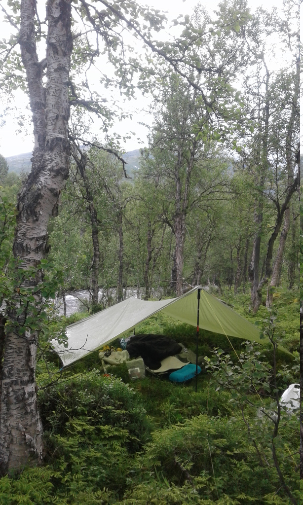
The last camp, in an impossibly waterlogged and slug-infested forest just upstream of Vettifossen. Not very cosy, but worth it for the privilege of having an evening splash in the stream above the cataracts:

After Vettifossen the trail descends very steeply into the valley, soon afterwards it becomes an unpaved road, and finally an asphalted road leading into Övre Årdal, from where you can take a bus to Oslo or Bergen. And that's about it.