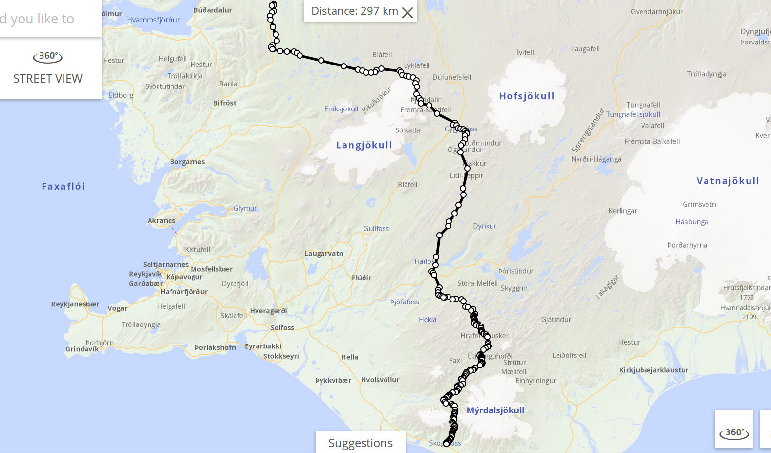
Iceland, from Skogar (south coast) along Laugavegur and then on across the highlands to Bordeyri (west coast), about 300 km:
Weather
+5°...20° both day and night, mean ~10°. Rain almost every day, but mostly light drizzle, glimpses of sun, windy.
Equipment
8 kg base weight + 9 kg of food. Flat tarp, quilt, trail running shoes, no ice equipment. For more details, see spreadsheet.html
Logistics
From Reykjavik, buses go in either direction along the ring road that encircles the island. Check e.g. nat.is for routes, departure times, and prices. There aren't many options, and they are expensive. There is lots of useful information about Iceland, including logistics, on Andrew Skurka's page.
Maps
I used a single paper map, namely Ferdakort Halendid, 1:250 000. It's not what you'd call very detailed, though, and it doesn't cover the coastal areas. Free topographic maps are also available online at http://kortasja.lmi.is/en.
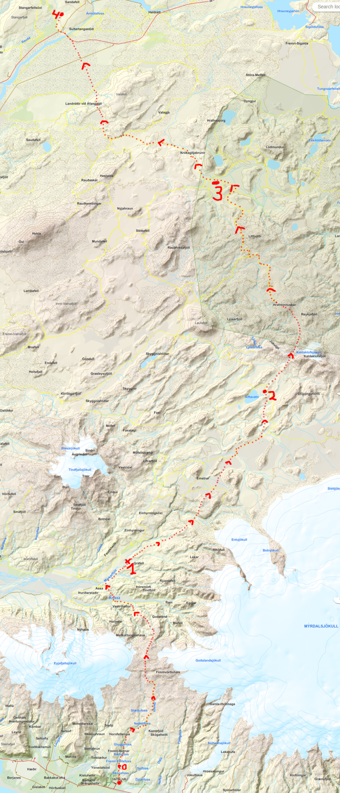
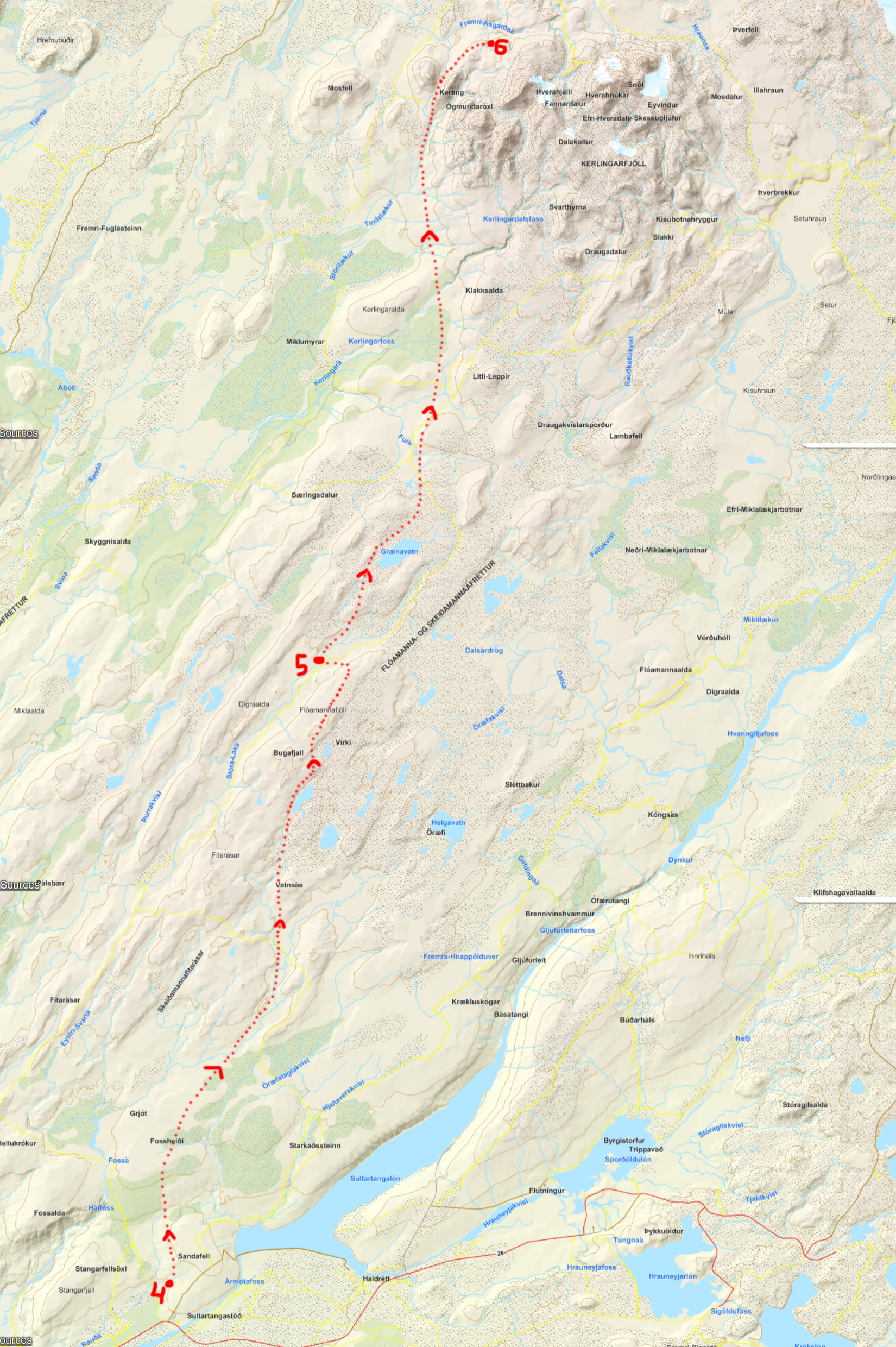
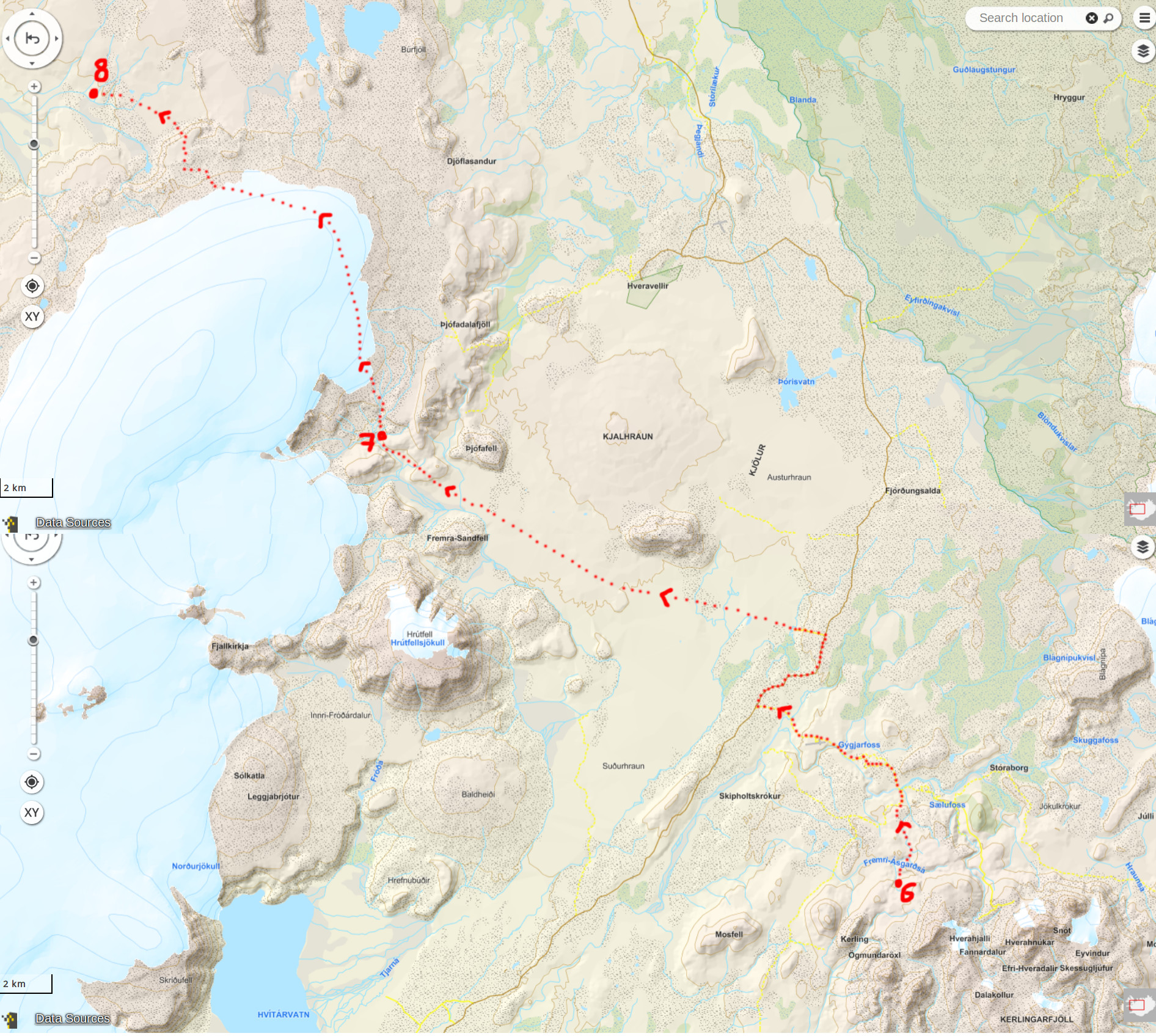
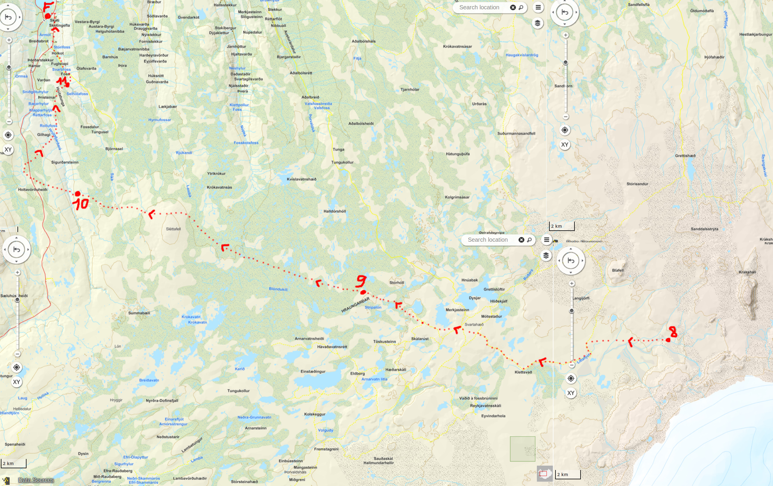
Days 1 - 4: Skogar to Þjórsá bridge
The route for days 1 through 4, ~ 100 km, was as follows (NB: very approximate, since Laugavegur is not shown on either this online map OR on Ferdakort Halendid, which was my only map):
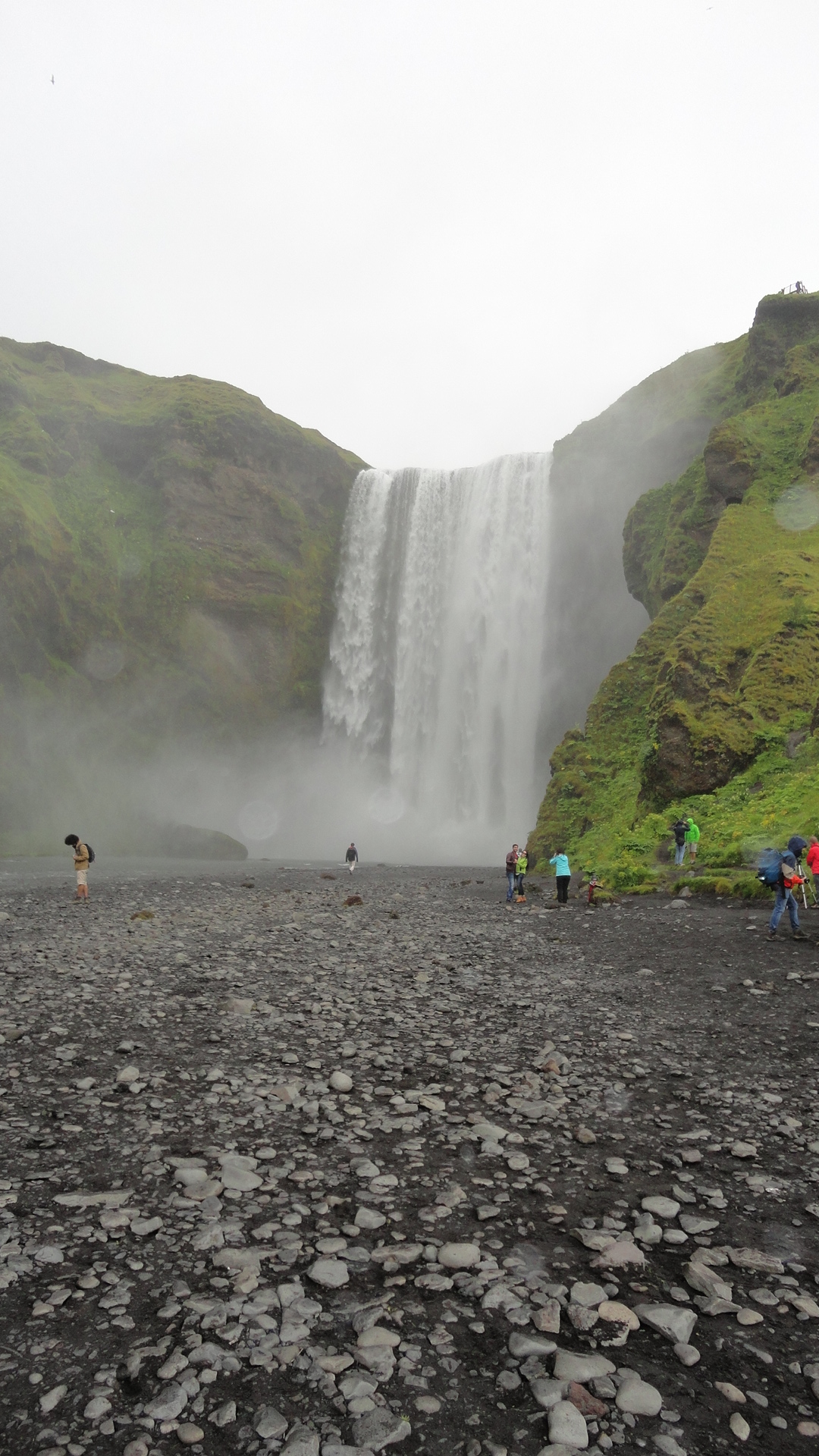
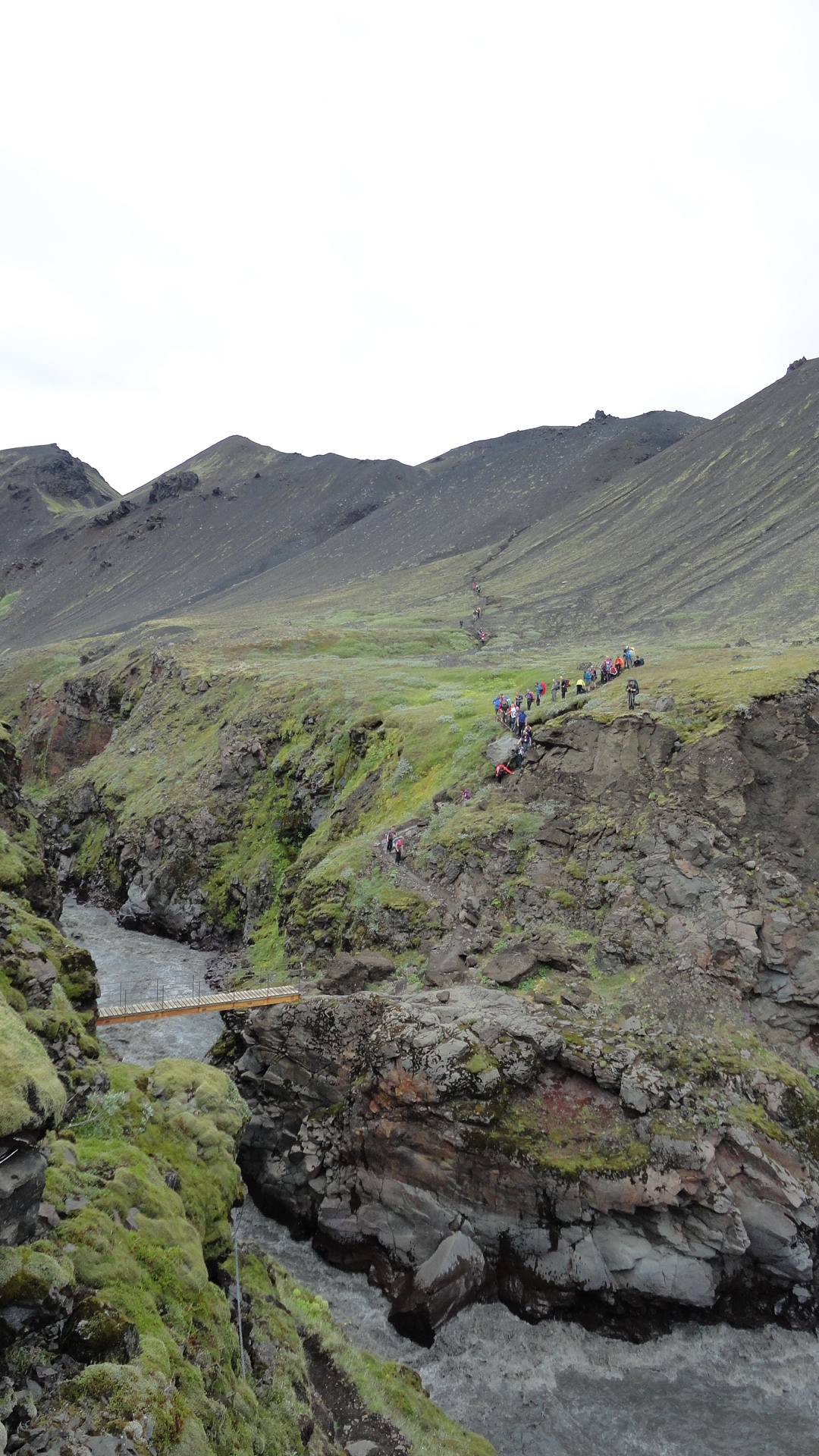
The route from the sourthern coast north to Landmannalaugar is the most famous hike in Iceland, known as Laugavegur. It's scenic, it's classic, it's justly famous... And it's so crowded that I regretted coming this way almost at once and veered off as soon as possible. So I won't talk too much about this section - look it up if you are interested. Skogar is an enormous camping site strategically located at the foot of the mighty Skogafoss waterfall:
Laugavegur starts right next to the waterfall: there is a stairway and then a path along the river and upstream, until it joins an unpaved road leading up the pass between the two glaciers. The next 80 km or so to Landmannalaugar are well-marked, and you are unlikely to get lost or even need a map, since there are legions of hikers passing this way. In fact, the only solitude I could get was in the early morning hours. Note also that the typical direction of walking Laugavegur is north to south, starting at higher elevations and gradually descending towards the coast. Doing it in the opposite direction, it is at least possible to avoid walking continously in the middle of other hikers. Still, as of 2016, this route is seriously overused, and the abundance of access roads also attracts numerous jeeps.
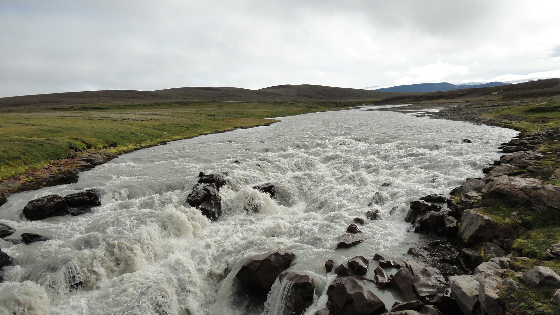
It took me 2.5 days to reach the penultimate shelter on the route, called Hrafntinnusker. Then I left Laugavegur and walked for another 1.5 days, partly on roads and partly across lava fields, until I reached the Þjórsá. This river is not fordable, at least not anywhere south of its home glacier of Hofsjökull, and there is only one bridge between its sources and the coast. So unless you are prepared to swim, the options for crossing are limited (but see here for a nice discussion of this point).
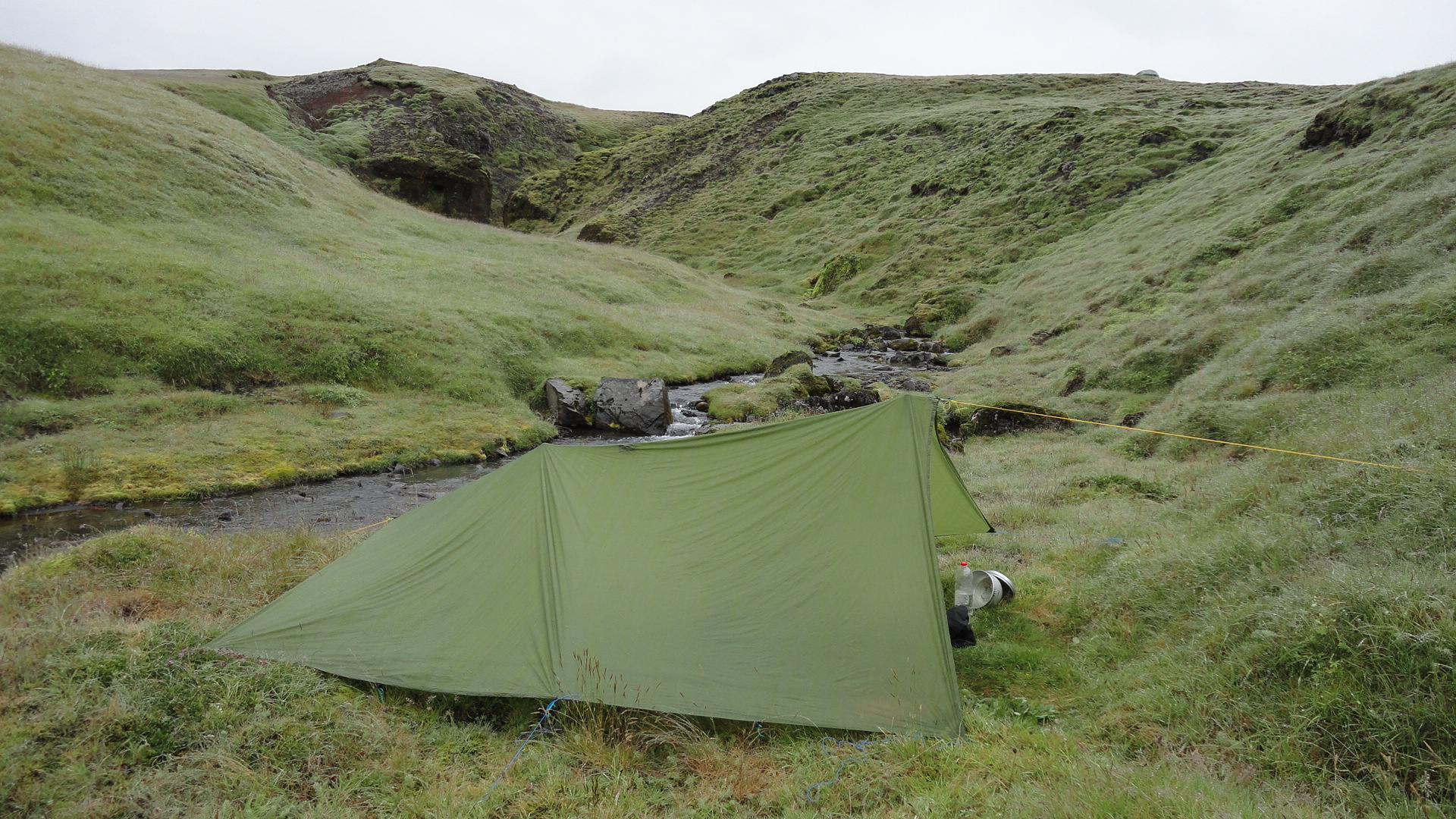
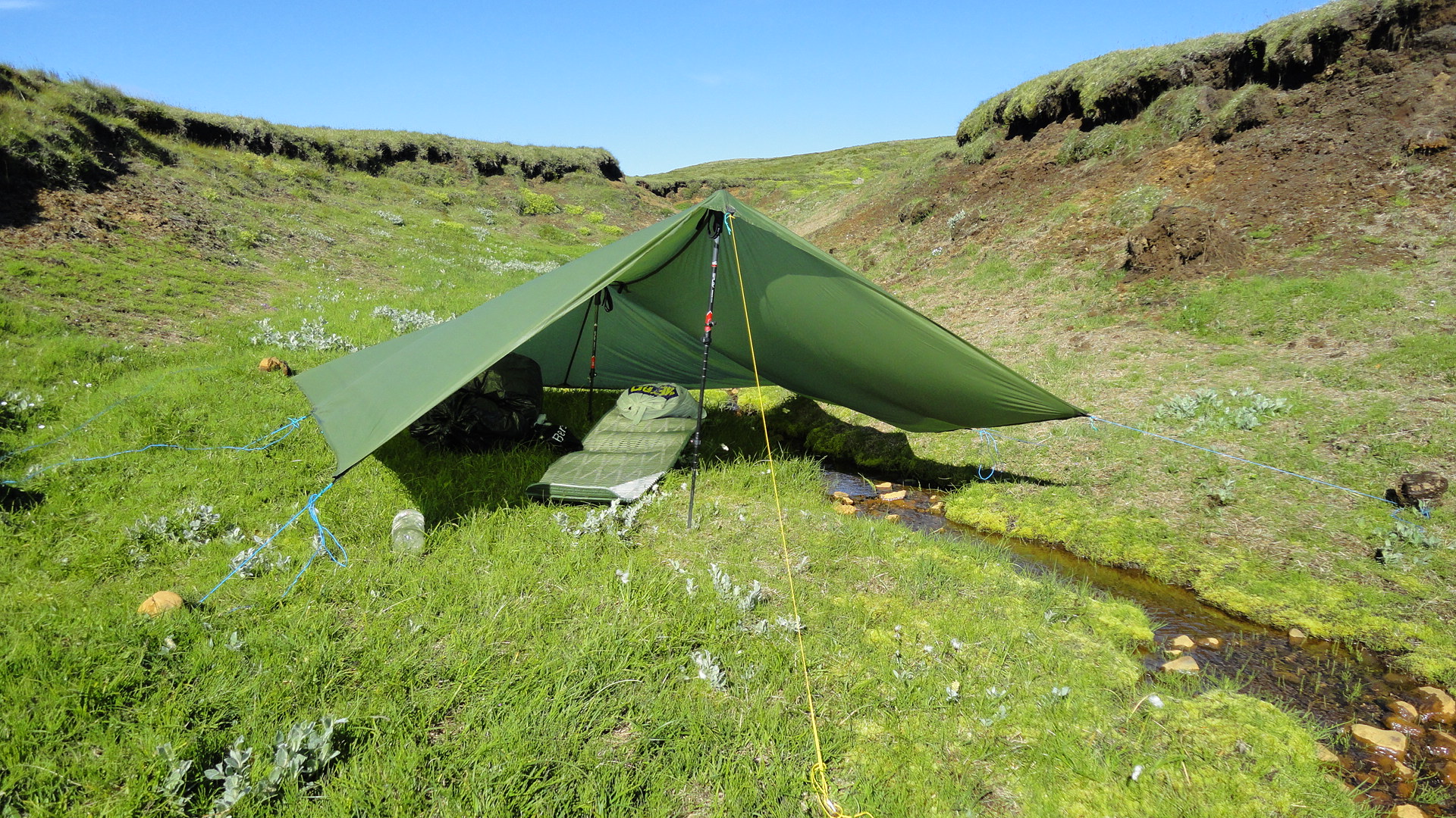
My first taste of light-weight hiking: seeking shelter from the wind was a paramount concern given my open flat tarp, and small creeks with steep banks were usually my first choice for camping. These idyllic meadows were dripping wet, by the way:
The quintessential Icelandic landscape:
Descending from the pass between Eyjafjallajökull and Godalandsjökull into the valley of Krossa:
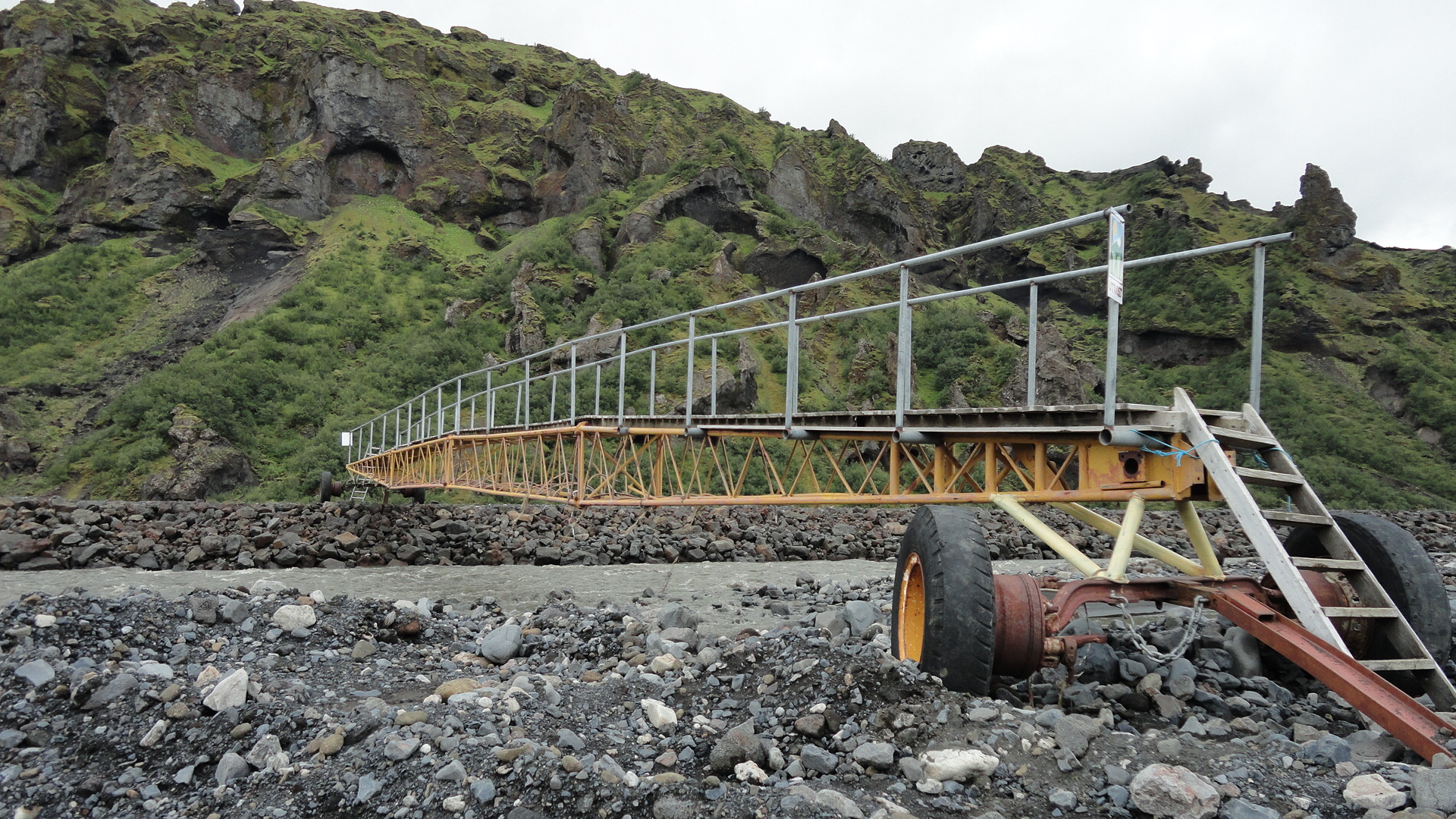
A bridge, Iceland style:
Markafjlot valley, near Porsmork:
The terrain is not as flat as it appears on the (2.5 km) topographic map, so a well-trodden path simplifies navigation considerably:
But you may need to queue up in order to cross that bridge. Get in line!
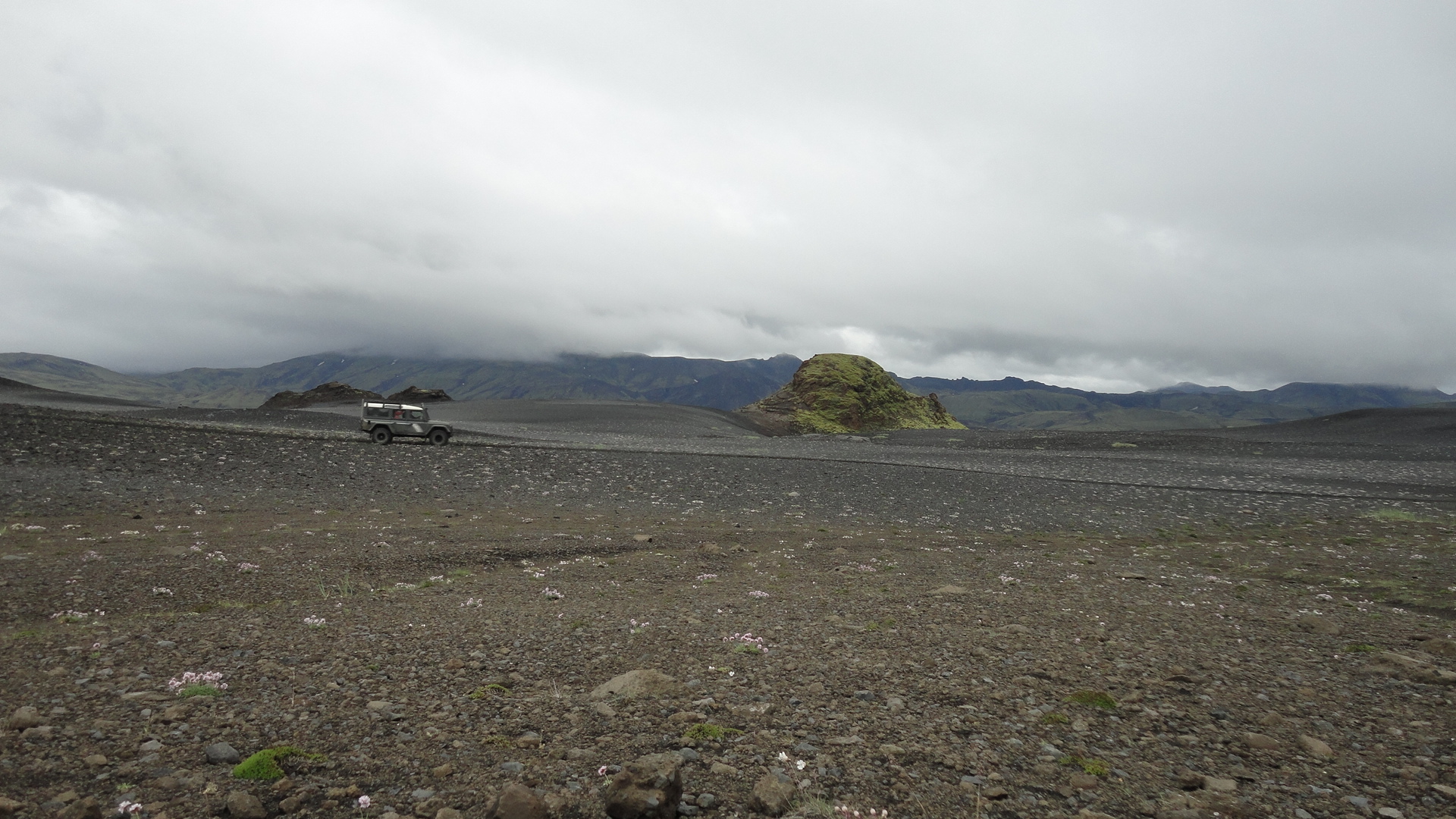
And, of course, there's nothing like a 4WD monster to enjoy nature in. Ah, the serenity...
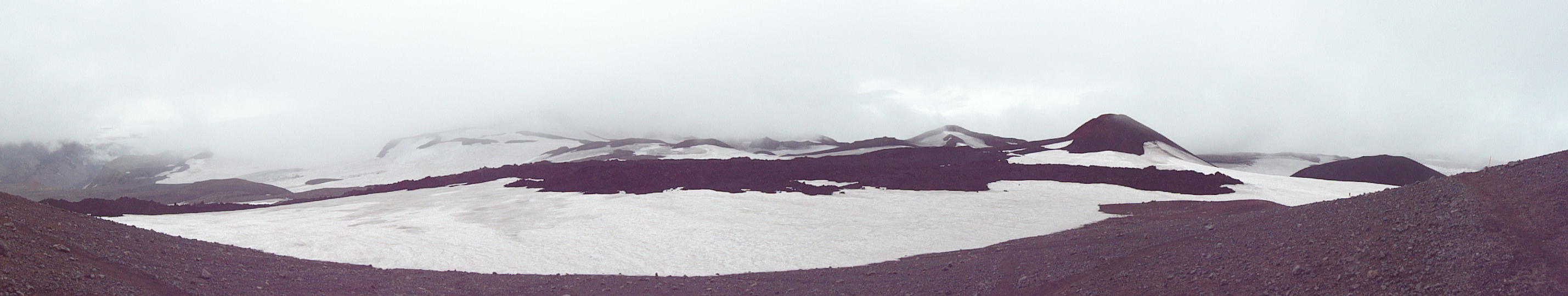
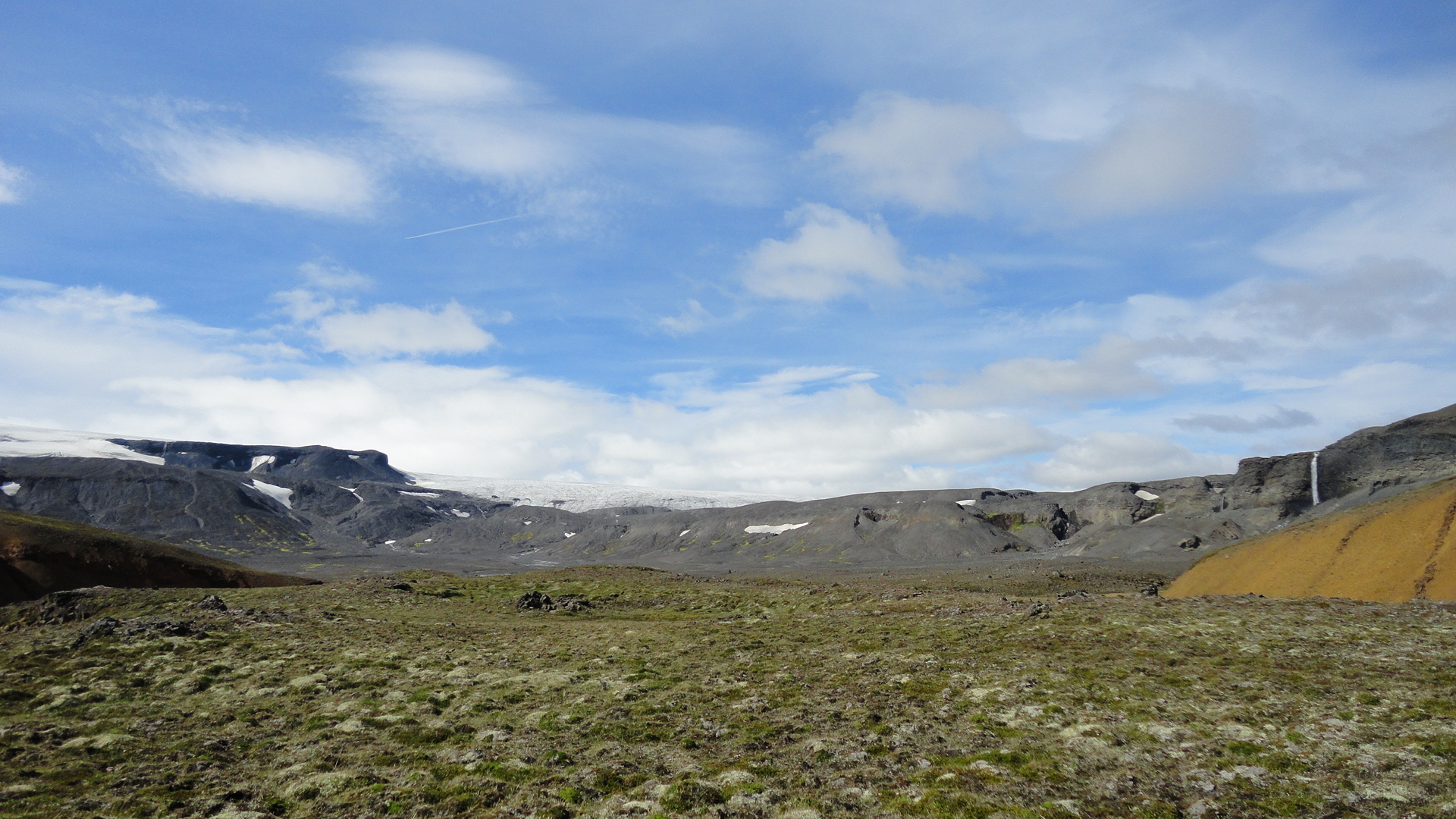
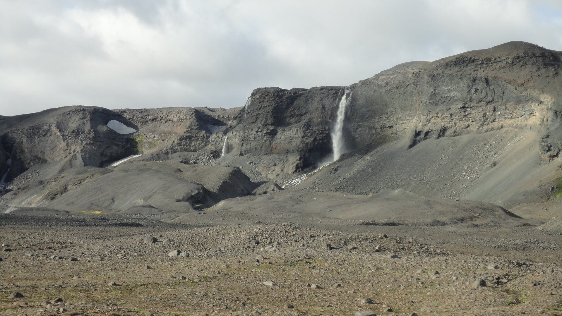
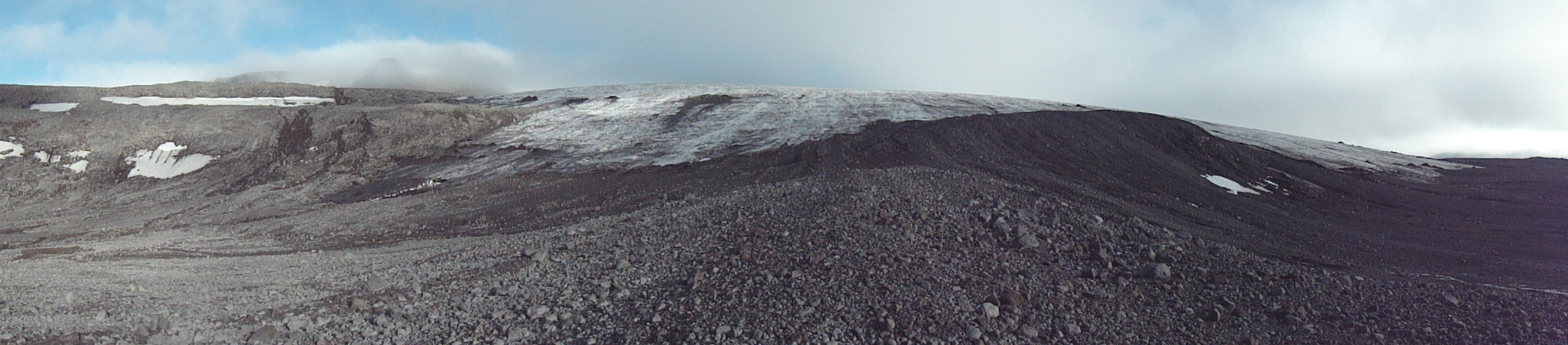
Hey, was that brimstone? Smoke and hot, sticky mud on the slopes around Hrafntinnusker:
Supply road, Iceland style. Yeap, those are ruts:
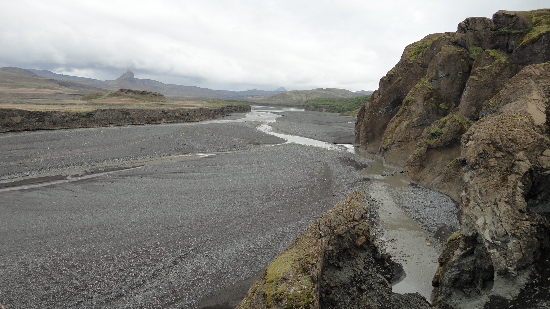
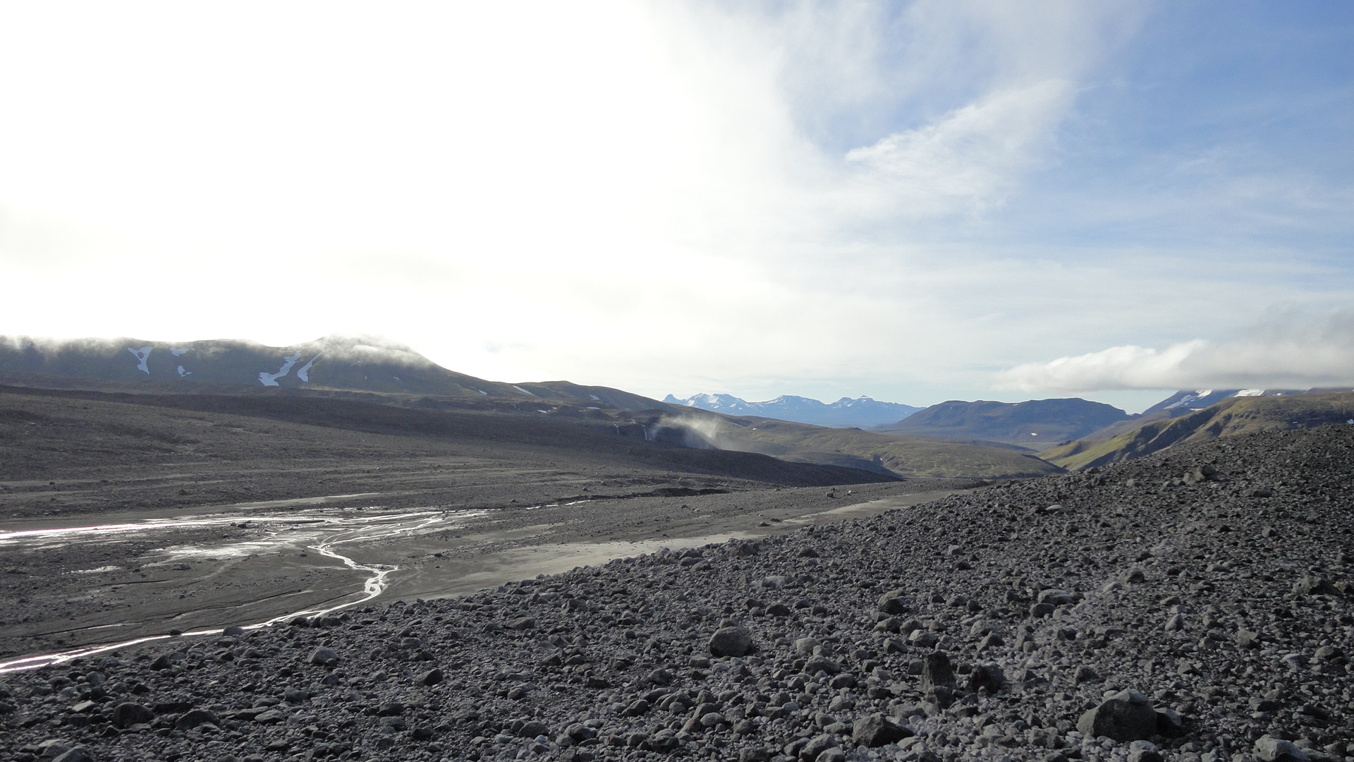
Approaching the Pjorsa: a lava field overgrown with moss. Very hard to walk on, but I'm not complaining - it's finally sunny!
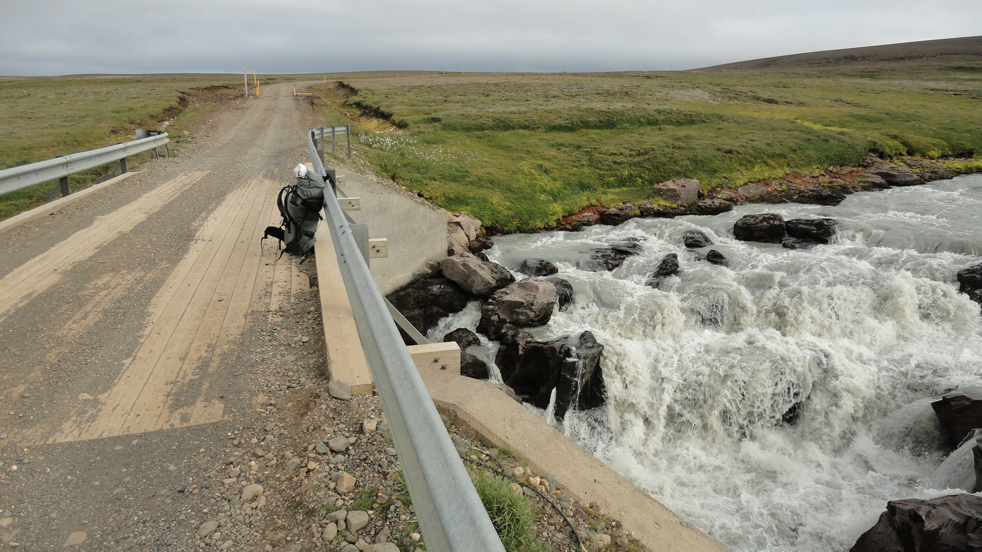
A field of volcanic ash with patches of lava. It can be as easy to walk on as a road, but the potholed lava can easily trap both the feet and the tips of trekking poles, so some caution is still required. The bridge over Pjorsa is just a few km away.
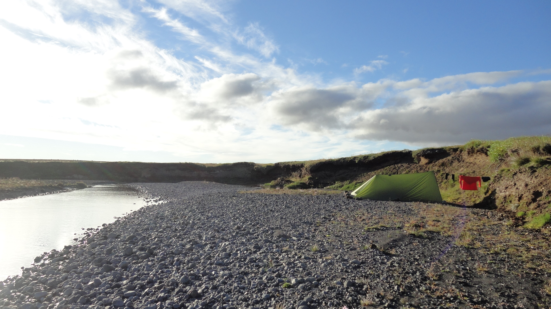
Finally on the west bank of Pjorsa! And what a happy invention: running water in the tent... hm, tarp:
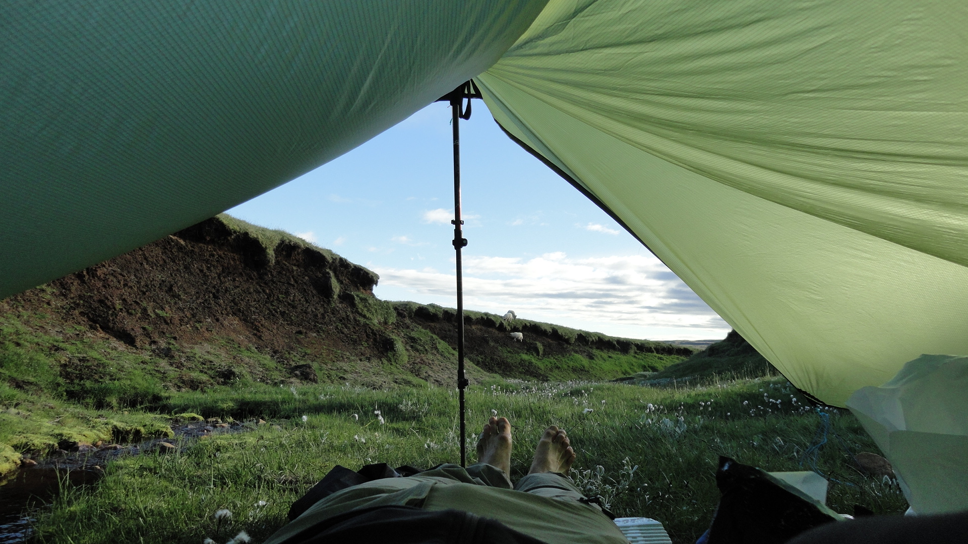
One thing I'll say for an open A-frame pitch: it gives you an intimate experience of nature. Enjoying the unobstructed view of a few sheep descending to my creek for their evening drink:
Days 5 - 6: Pjorsa to Kerlingarfjöll
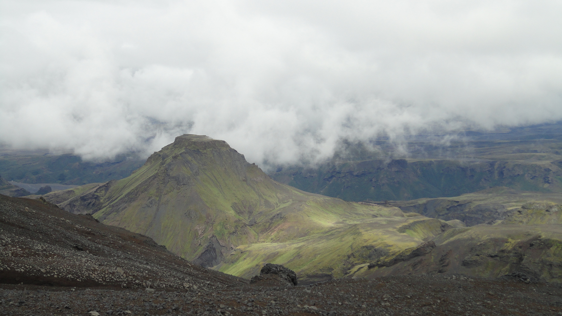
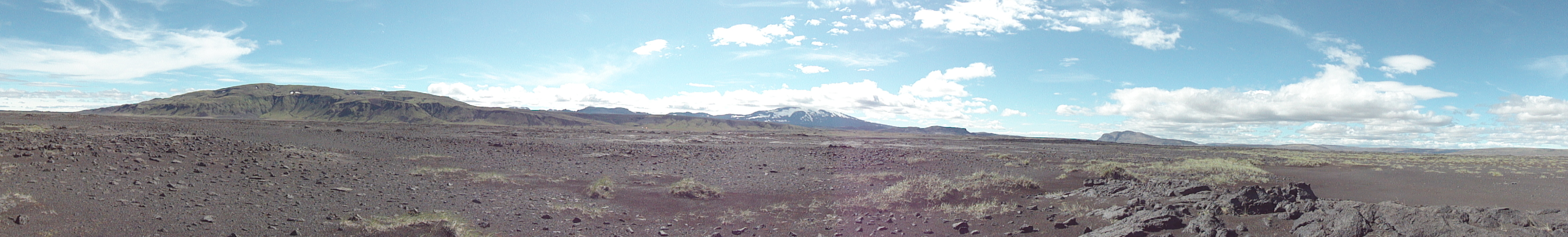
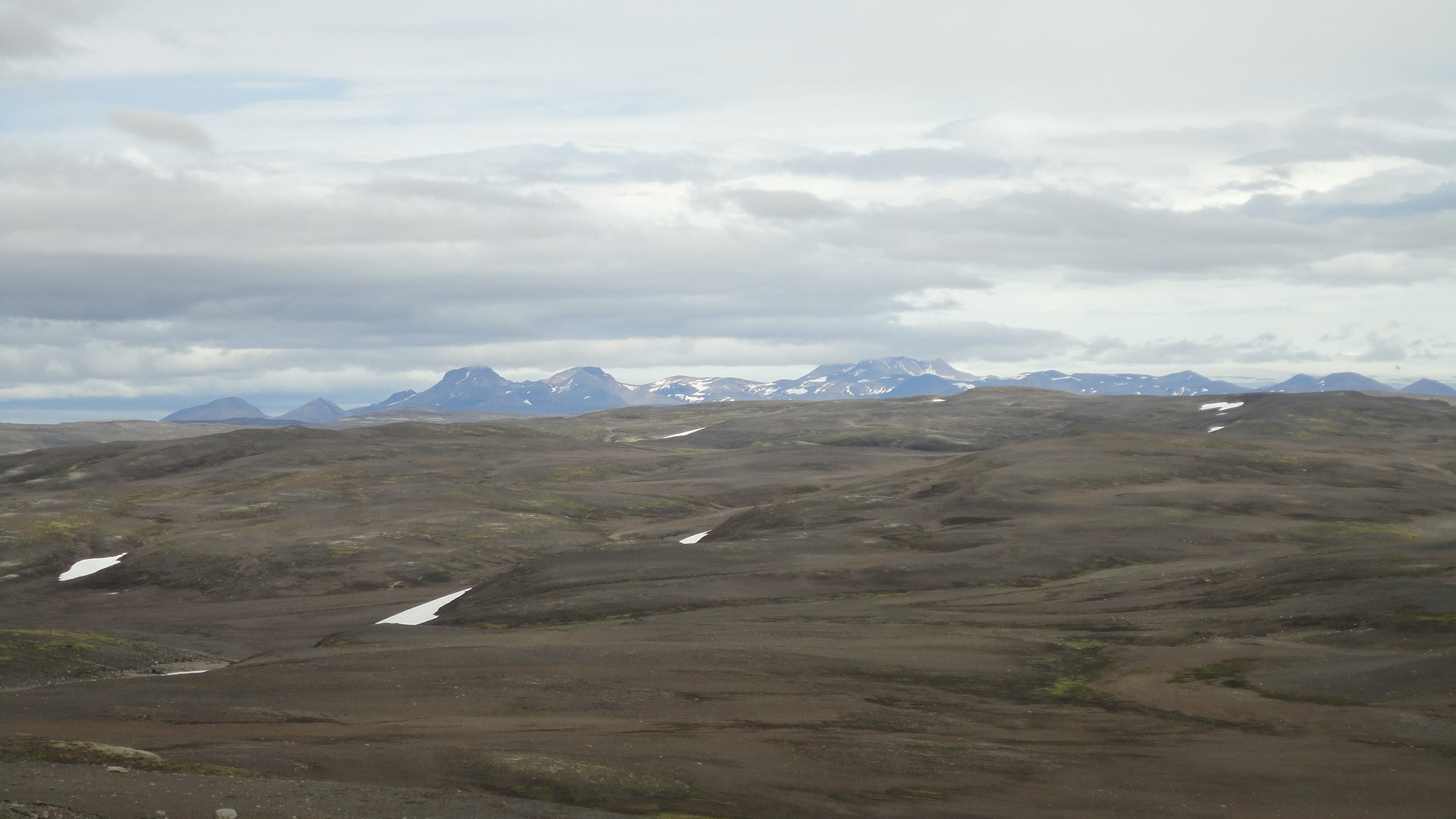
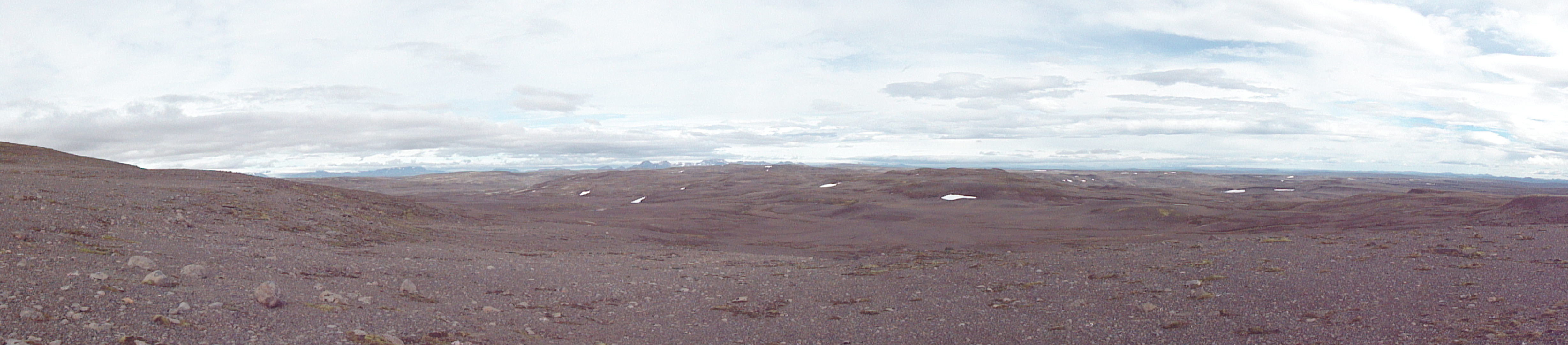
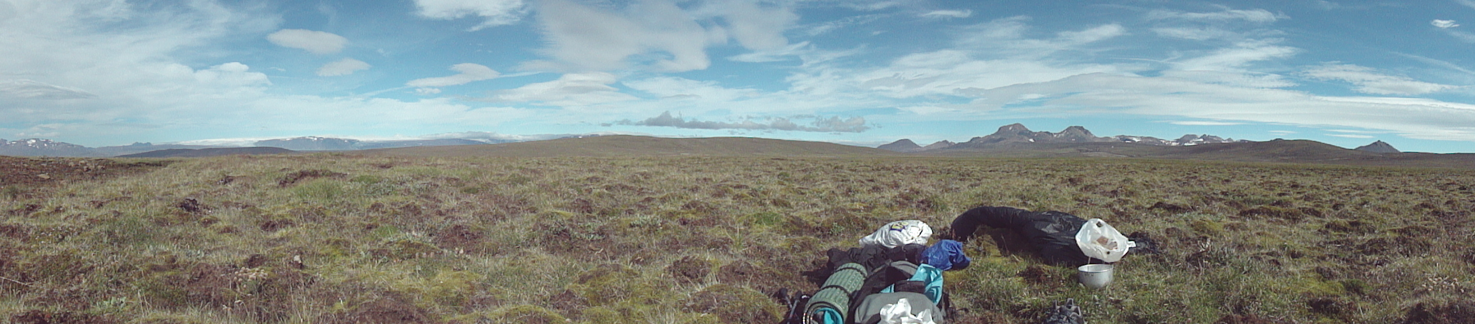
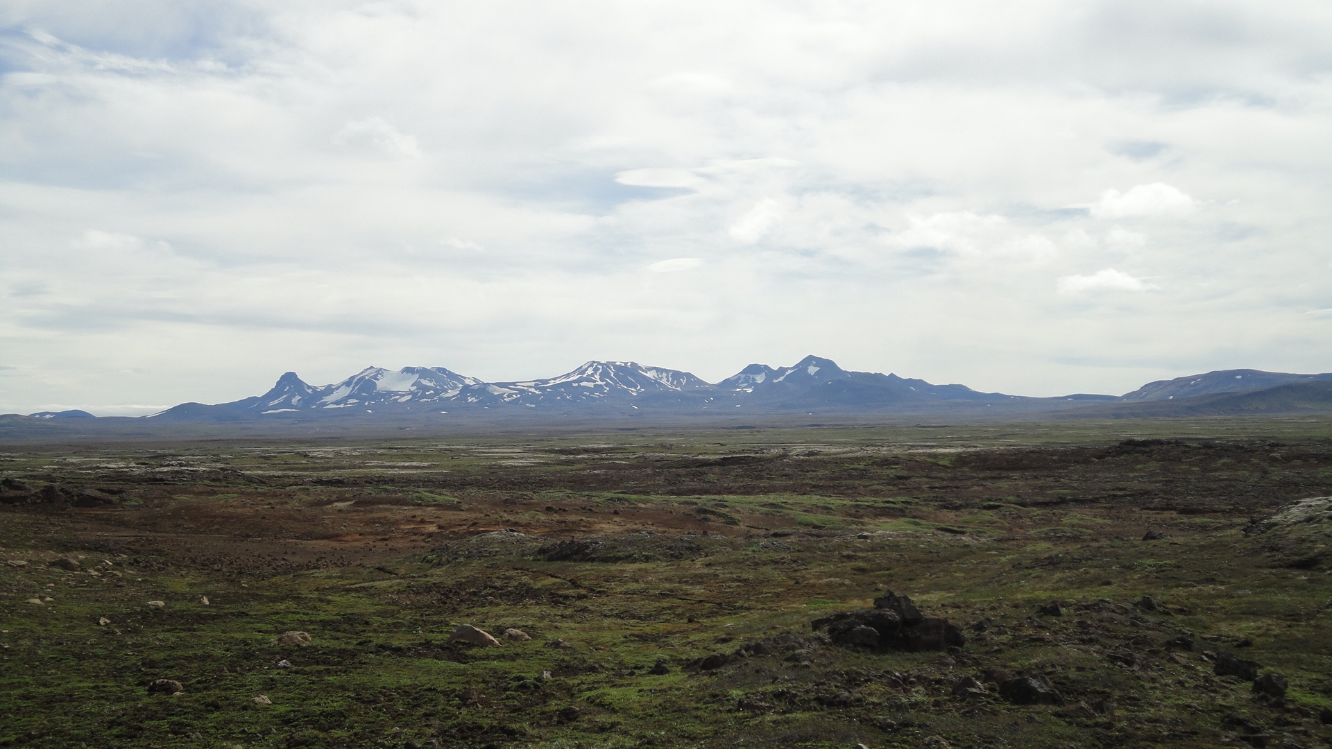
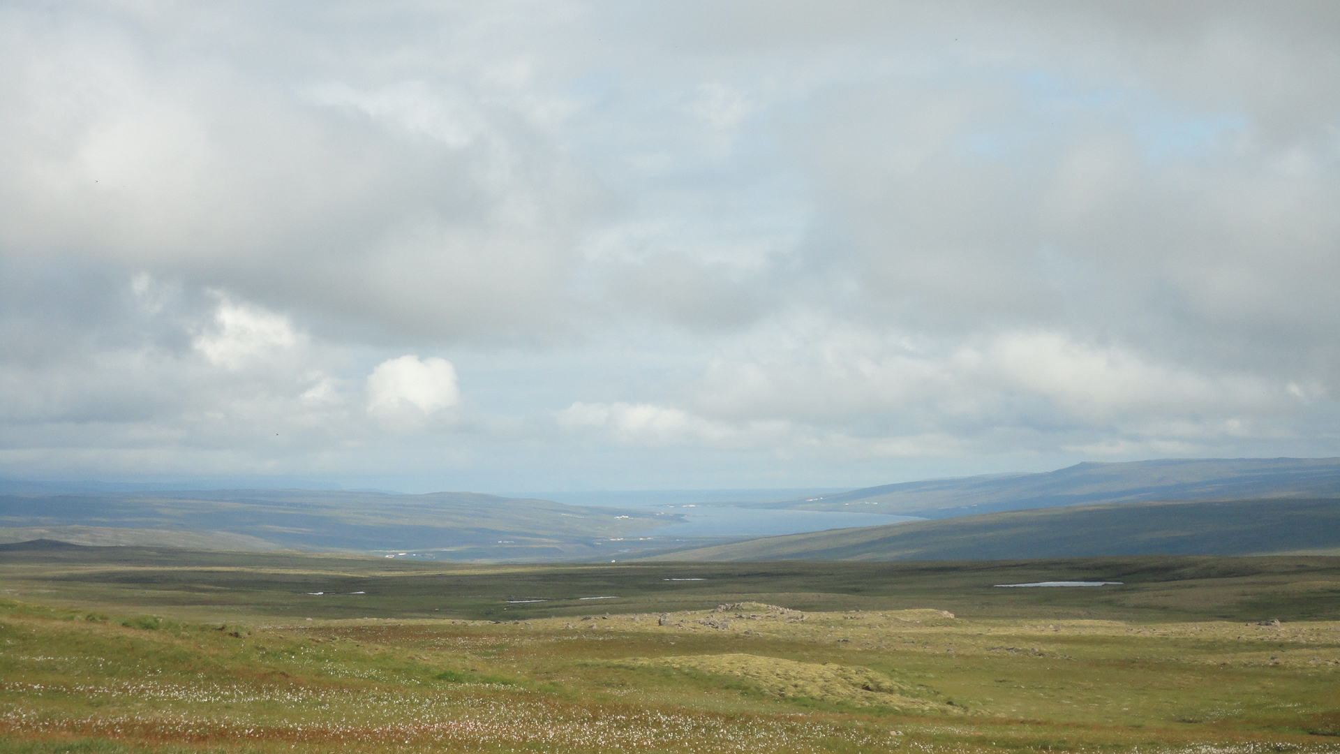
In marked contrast to the hyper-popular Laugavegur, this corner of Iceland is completely deserted - it's wild, barren, windswept, featureless, and just plain empty of everything except a few tufts of grass and snowfields. In two days I didn't meet a single person and saw only one or two ghost-like dirt tracks. These hills are relatively flat and easy to cross, and I found the monotony of this land strangely endearing. On a clear day you can see dozens of kilometers in every direction, from Hekla volcano in the south to Kerlingarfjöll in the north. Langjökull comes into view as you approach Kerligarfjöll. The distances are immense, and hour after hour goes by without any visible change on the horizon. This is quite a contrast to Laugavegur and, in fact, to most mountain hikes, which happen on a small scale, with views obstructed by hills and boulders and the progress slow because of the rough terrain. But here you can feel the slow rhythm of a cosmic journey!
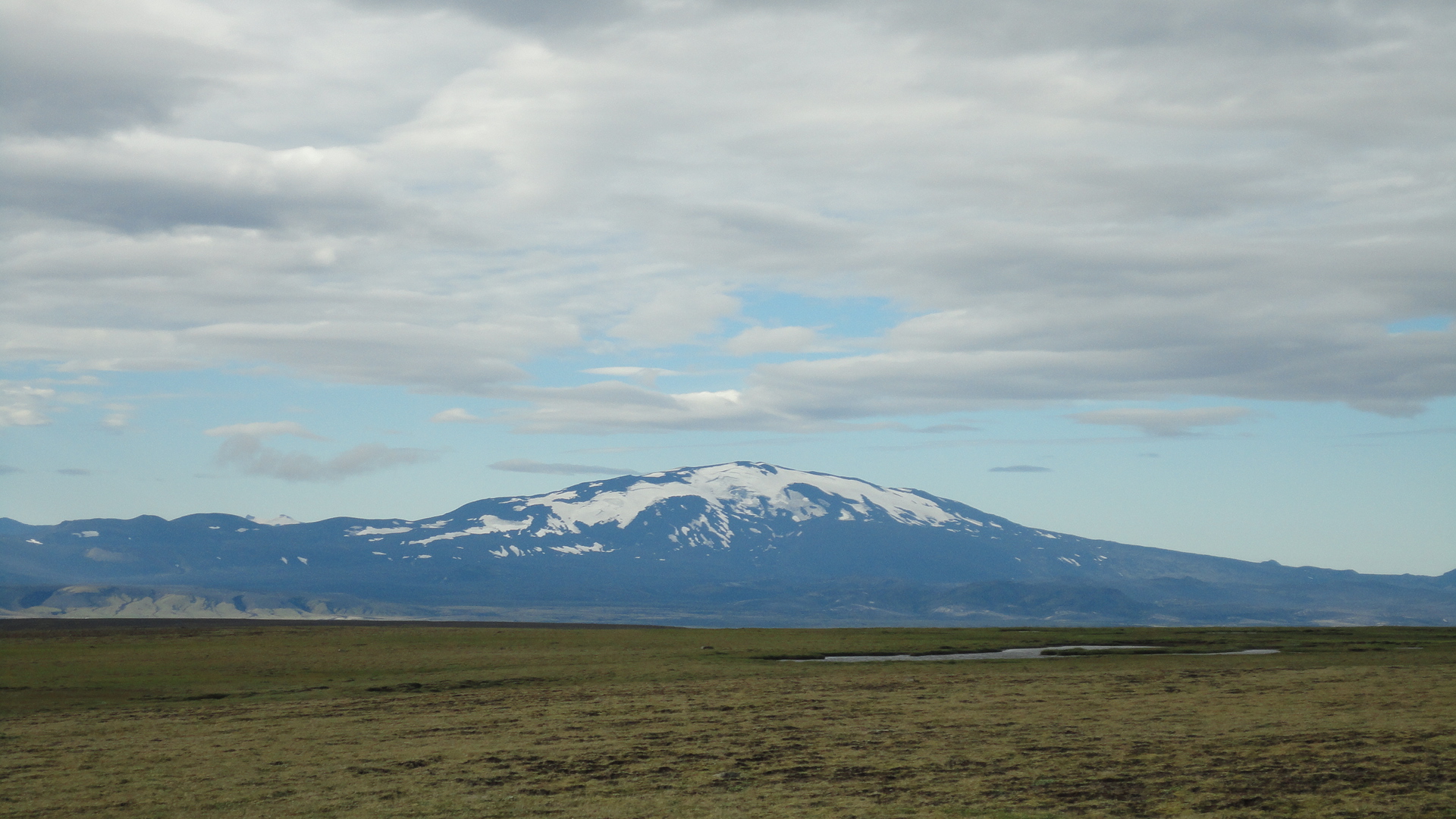
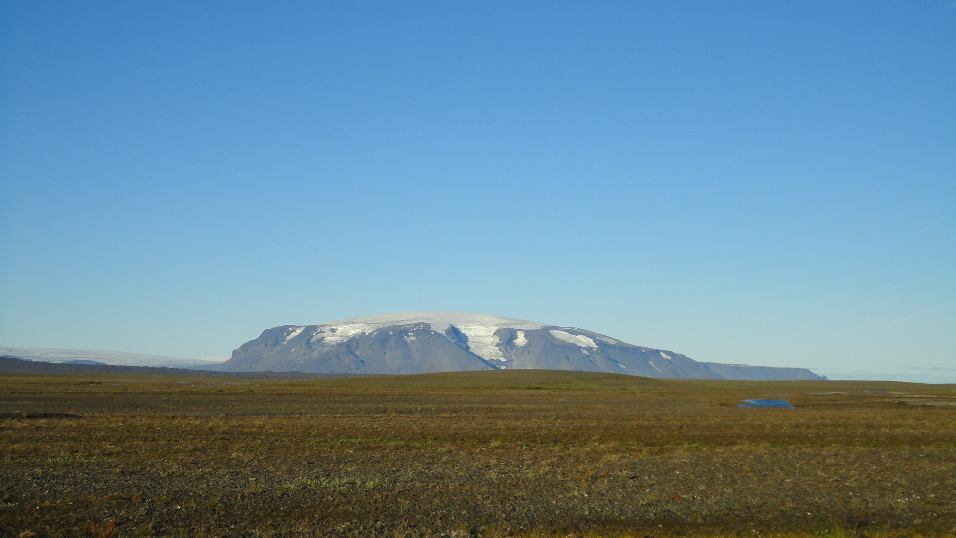
Hekla (1491 m), a landmark volcano south of the Pjorsa. There is a road leading nearly to the top, and the rest looks like an easy walk. Perhaps a little too easy to justify a detour...
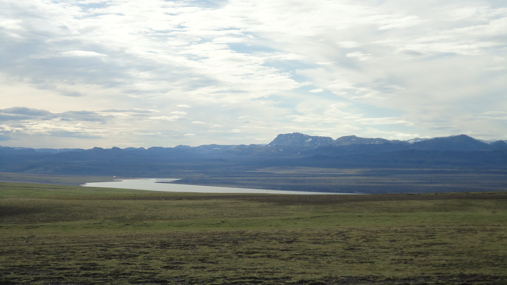
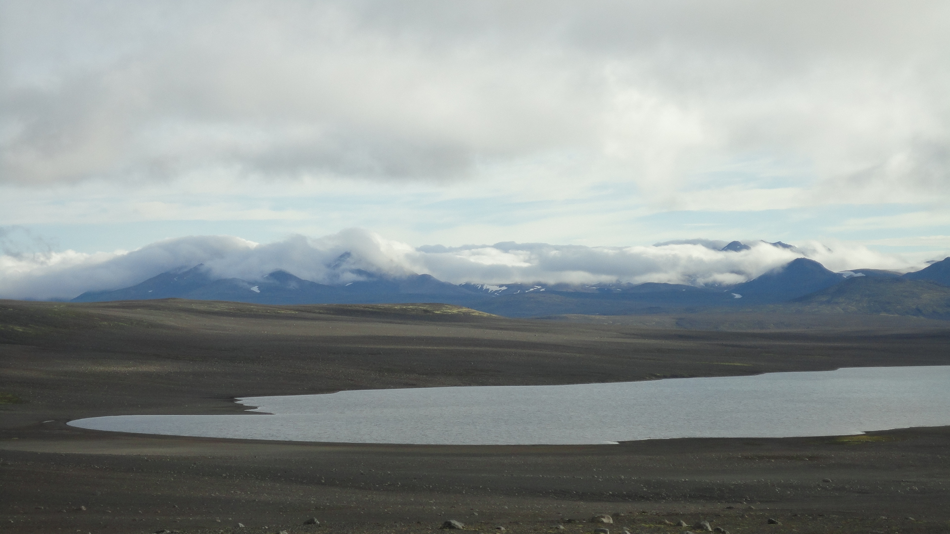
A view across the Pjorsa. A couple of days beyond those hills lies the giant glacier - Vatnajökull:
Kerlingarfjöll mountain range on the horizon. It took me two days to reach it:
Yes, it's THAT empty:
One day closer to Kerlingarfjöll mountains. They are clothed in clouds today:
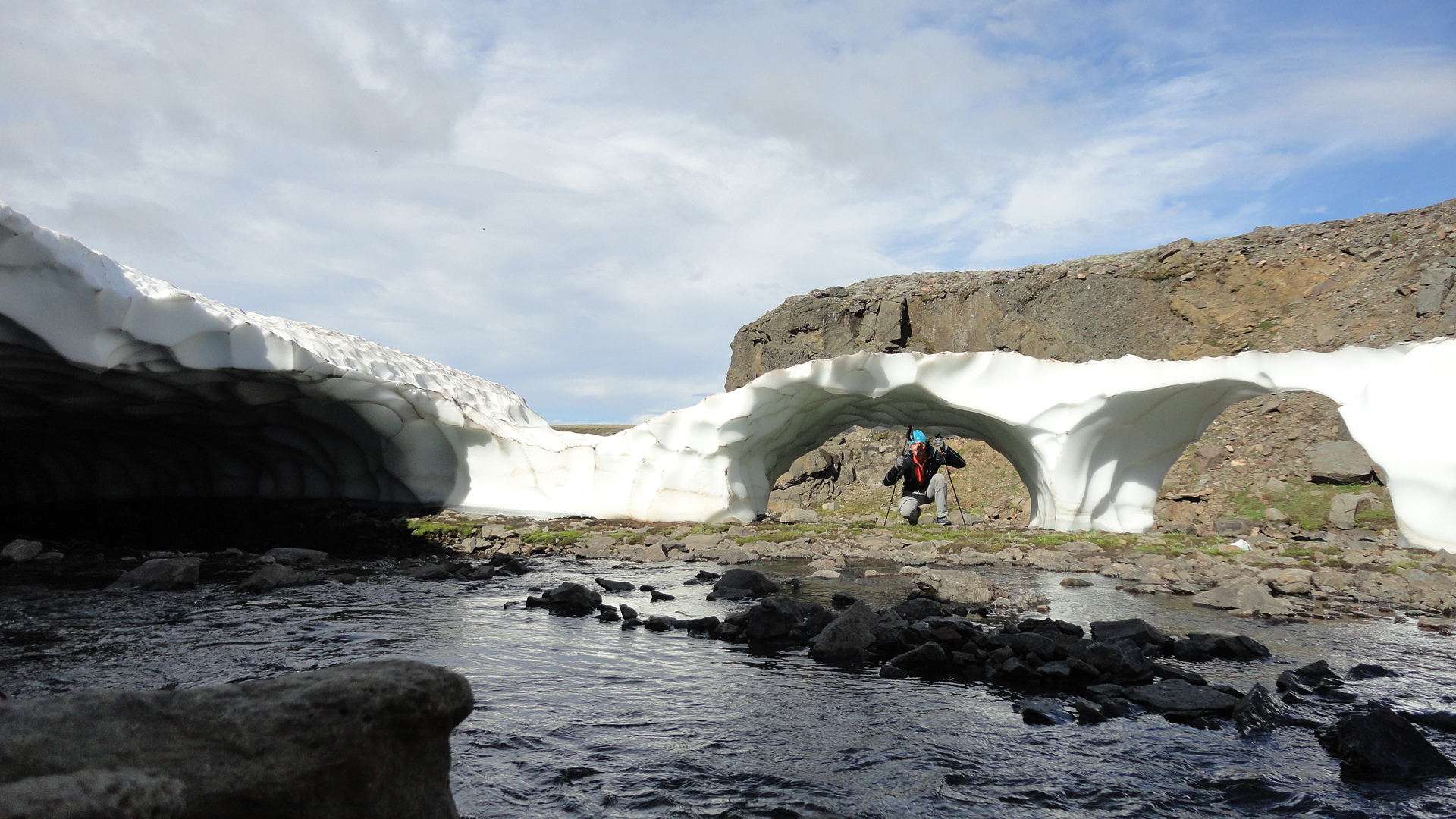
Snowfields are plentifull, but such perfect arches are not exactly a dime a dozen, not even in Iceland:
Looks like Mongolia, doesn't it?
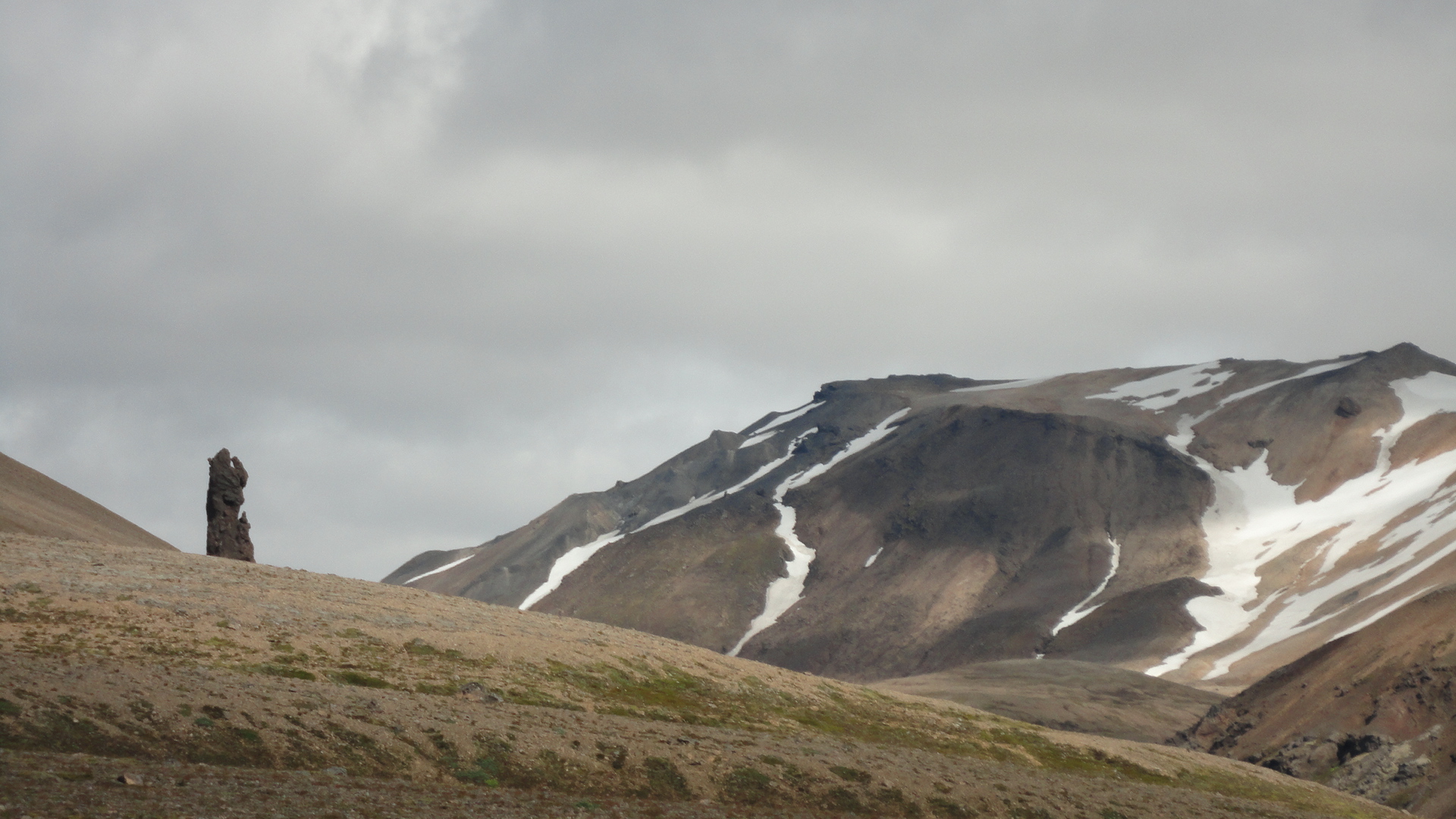
Finally, passing Kerlingarfjöll! A marvellous standing stone on the slopes of Skeljafell is like a sentinel guarding the passage:
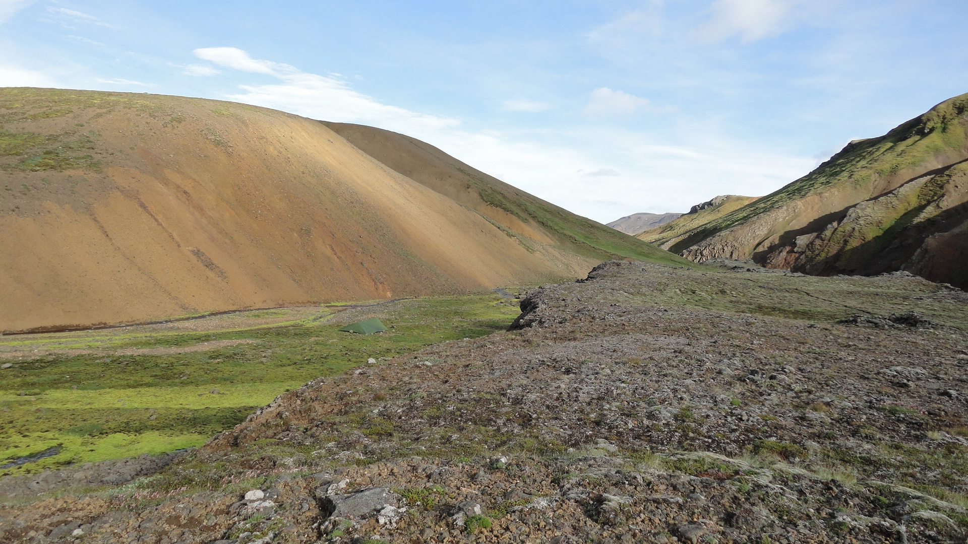
These mountains look very, very promising. Nowhere near as popular with hikers as Laugavegur, this region is just as beautiful and more pristine. Unfortunately, I didn't have the time to make a circuit and only passed through quickly, but I loved what little I saw. I stayed one night - a perfect camp and the first proper, full-body wash since the beginning of the trip:
Days 7 - 8: Kerlingarfjöll to the marshes
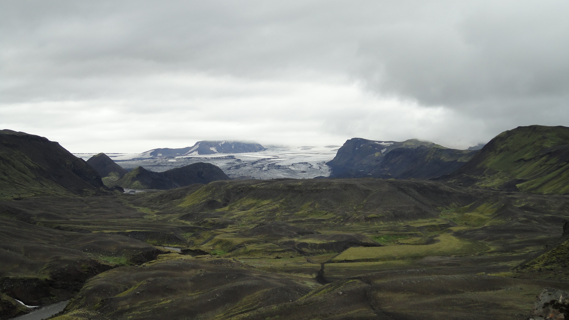
Kerlingarfjöll mountains sit in between two giant glaciers - Langjökull and Hafsjökull. The rest of this inter-glacial plain is mostly flat, and it is bisected by many minor unpaved roads and a major highway. There are also several powerful rivers, which are best crossed by bridge, which means having to follow the roads. As such, it's not the best place for hiking, but at least it can be left behind quickly and easily. I was not sure whether I would continue straight north or turn west around Langjökull, but finally I made up my mind to go west.
The kind of river I wouldn't care to ford unless I must. Jökullkvist just north of Kerlingarfjöll and a most convenient bridge:
One last longing look at Kerlingarfjöll, this time from the north:
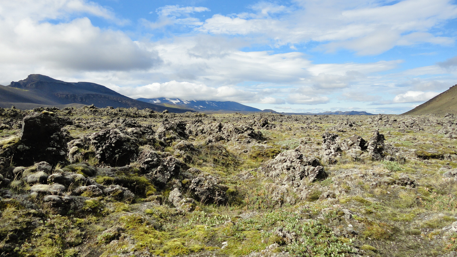
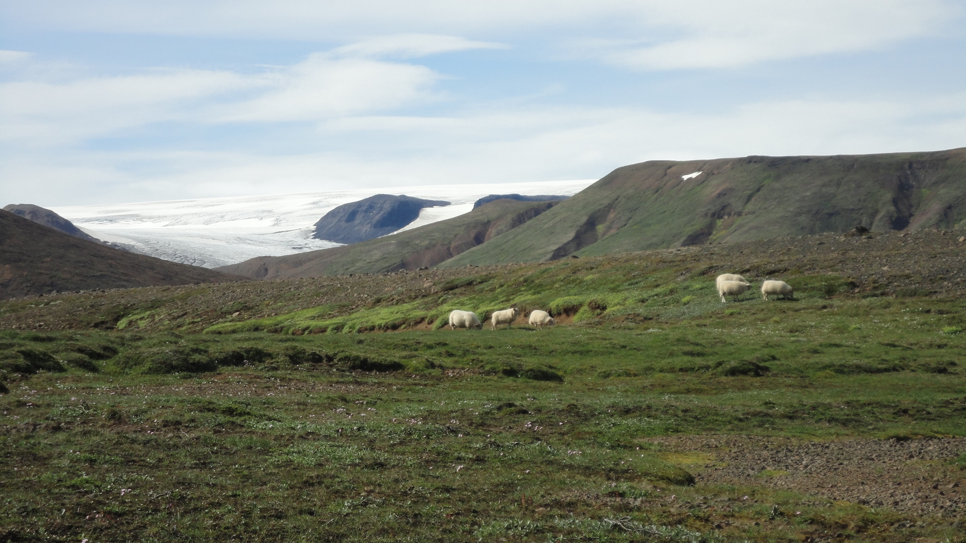
After endless lava fields, the edge of Langjökull is unexpectedly verdant and pastoral:
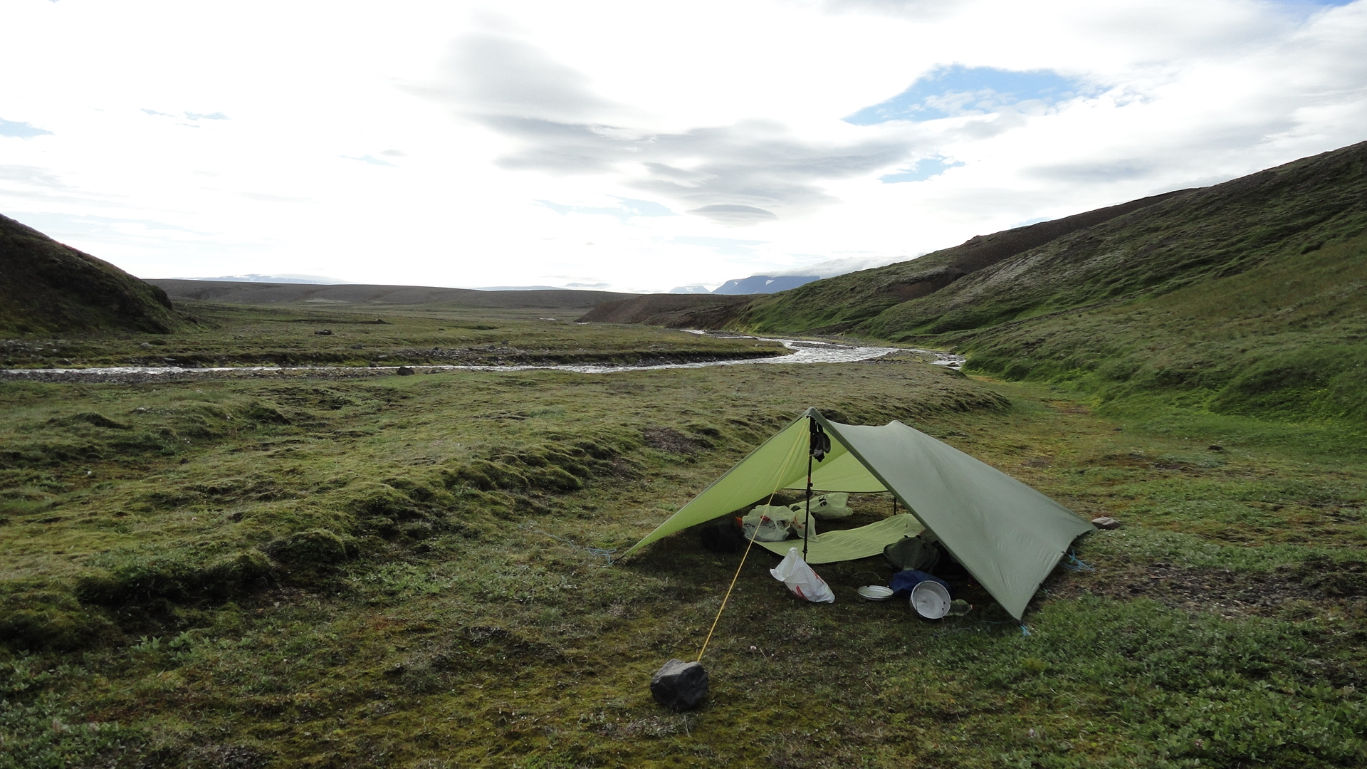
My seventh camp site just before the final ascent to Langjökull. I have seldom spent a night at a more stunning location. Windy and bitterly cold, but beautiful to the point of awakening a religious experience:
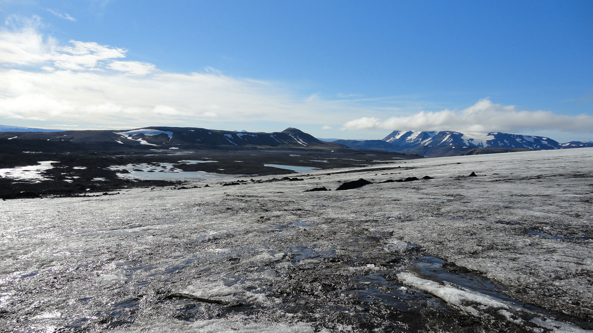
My initial intention was to follow Hundadalir around Langjökull without going on the glacier itself, but the moraine under the melting edge of the ice is so waterlogged that there is hardly any foothold:
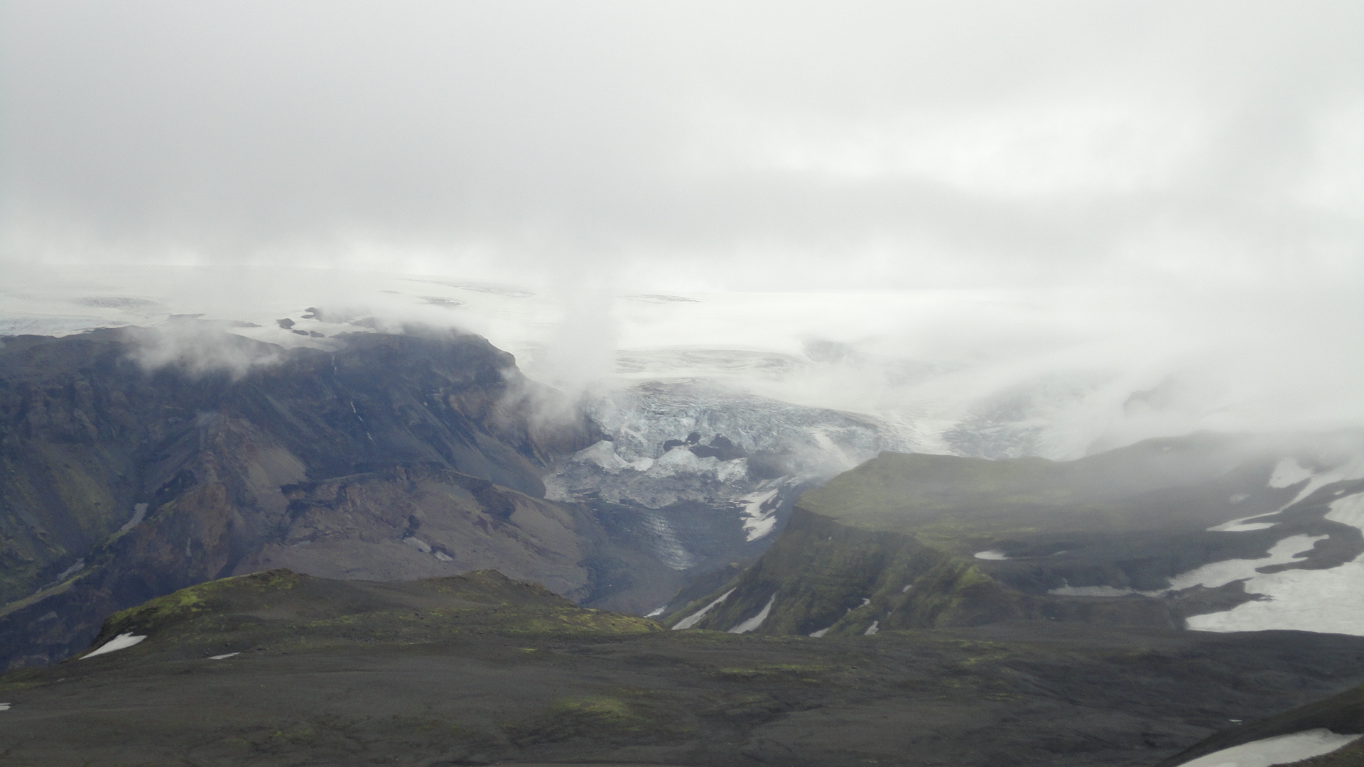
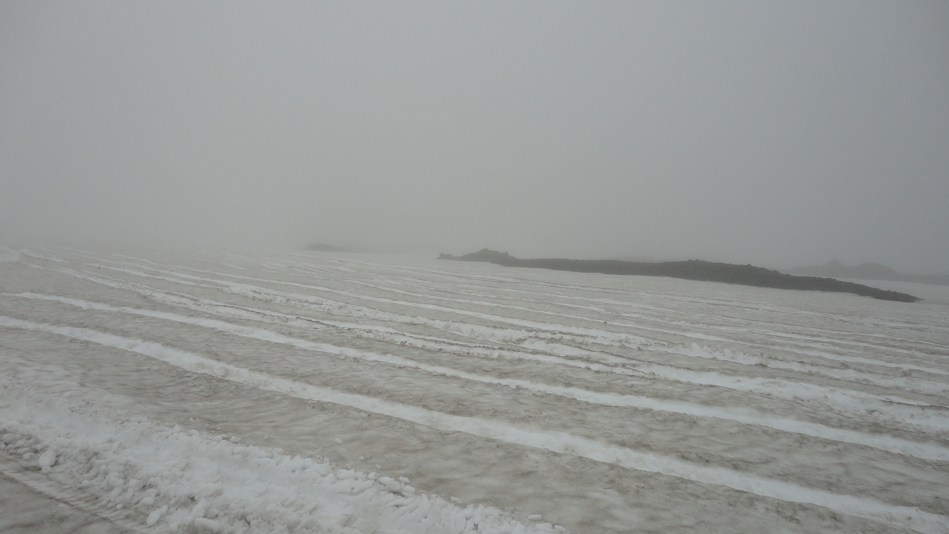
After boulder-hopping and sinking into the ice-cold mud for half an hour, I had had enough and decided to try my luck on the ice. Much more like it! (Mostly) bare ice, with only a few clearly visible cracks. The angle was very gentle, so this particular end of Langjökull - and in these weather conditions - could be negotiated with no special equipment. And the views...
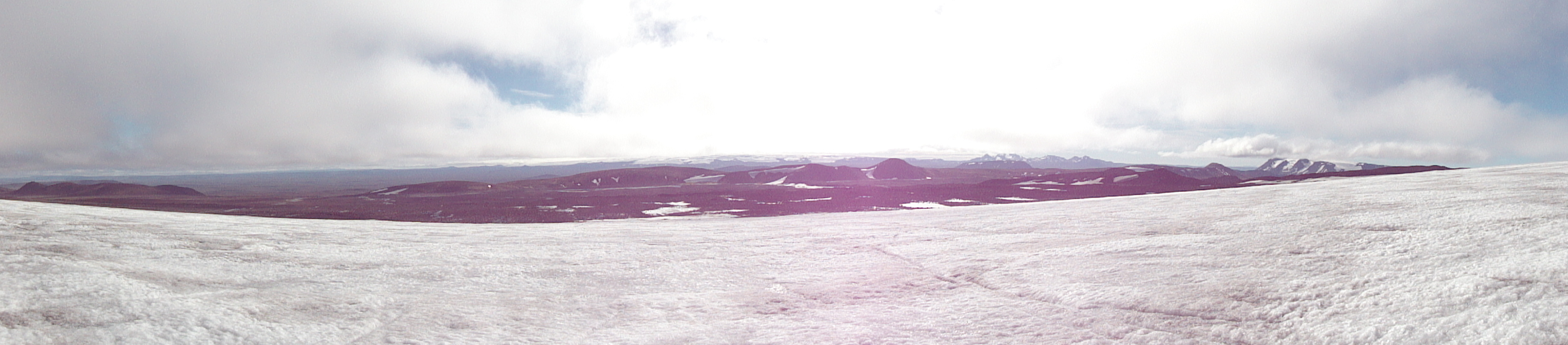
After a rapid 3-hour transit over the tip of the glacier and some painstaking scramble over the moraine on the other side, endless plains again. The white-capped peak on the horizon is Eiriksjökull (1675 m). I will spend the next two days looking at it:
A rare sunny and calm sunset - a perfect occasion to catch up with the laundry:
Days 9 - 11: the marshes
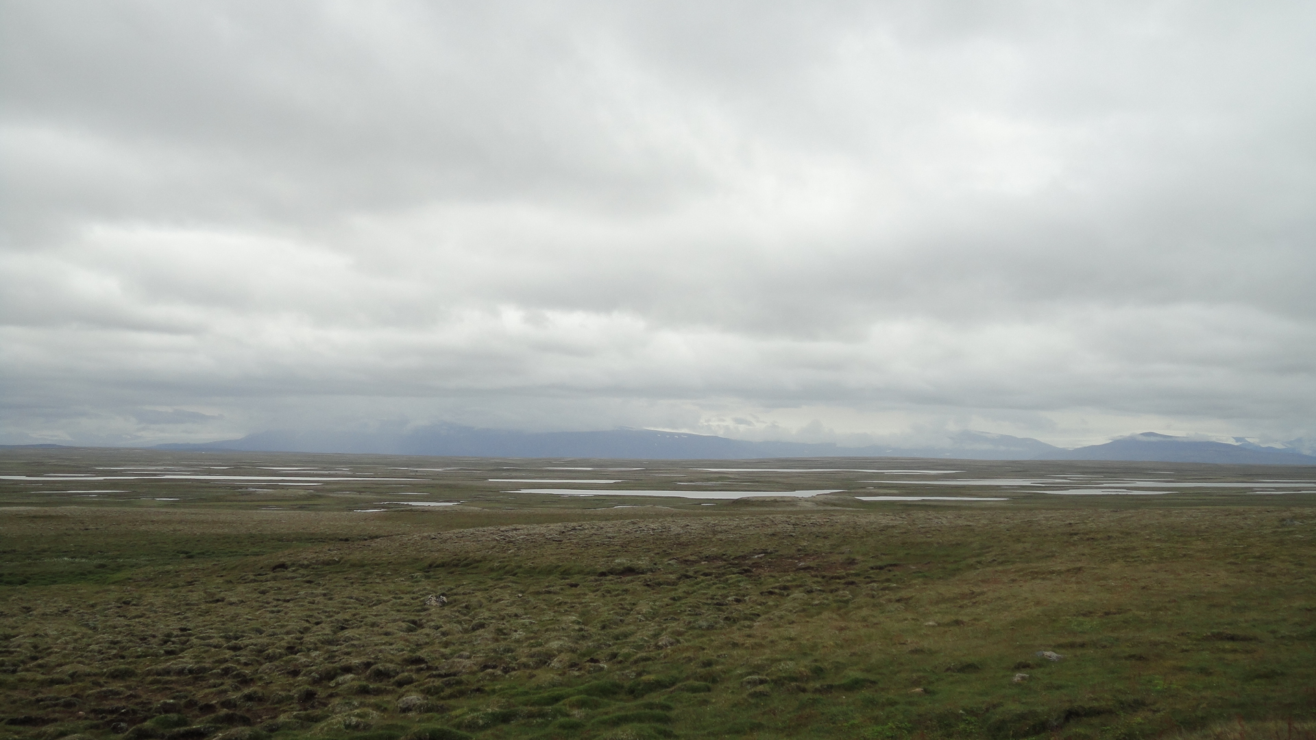
The final and possibly weirdest part of my journey was crossing the plains between Langjökull and the ring road, aiming for the coast near Bordeyri. This seems like a simple task, but Ferdakort Halendid map doesn't quite reach the coast, and navigation on the nearly featureless plains is a pain without a GPS. In addition, the area lovingly called Arnarvatnsheidi is a kind of marshland at its best and a bog at its worst. The coastal region is not much drier, either, making this a very wet stretch indeed.
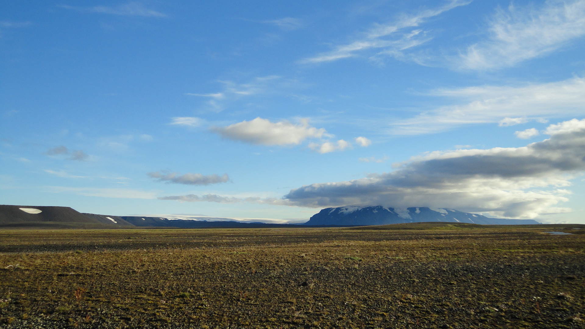
Initially the plain is desert-like and as smooth as a board, making for rapid progress. Then some grass appears. Eiriksjökull is the best landmark, tremendously helpful for navigation:
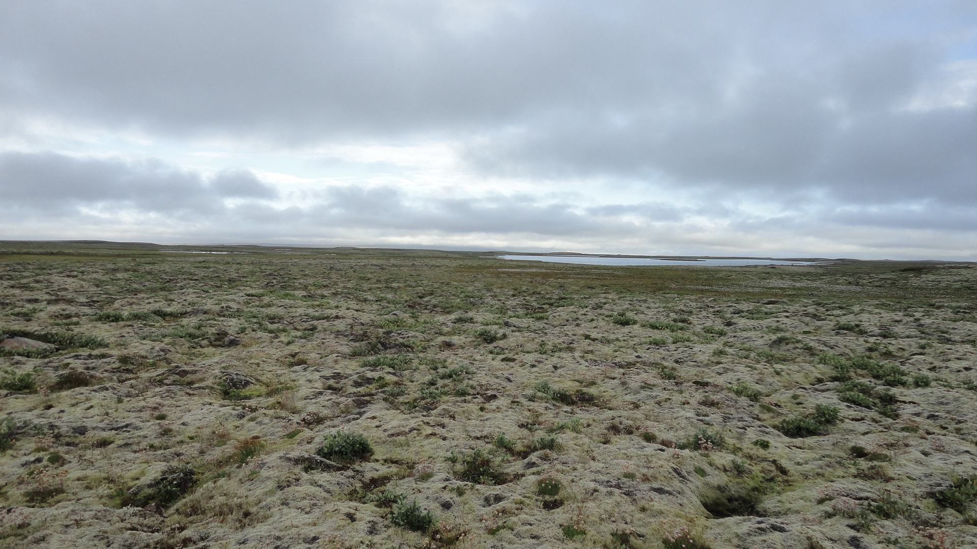
Further west the ground becomes increasingly swampy, with mosses and countless lakes:
And then the marhes proper take over. The only support for a walker is provided by giant tufts of sedges that grow between pools of stagnant water. Getting clean drinking water can be a problem because of the abundance of sheep and the lack of current in the numerous pools: